Alex Ihnen writes about the fast moving proposal to convert 1-mile of the elevated I-70 highway separating downtown St. Louis from its historic riverfront.


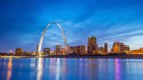
Recently the city's development corporation released its "Request for Proposals for Downtown Multimodal Access Study," the most significant step yet in efforts to convert a portion of I-70, adjacent to the famed Gateway Arch and the Jefferson National Expansion Memorial park, into an urban boulevard, reports Ihnen.
According to Ihnen, "The aging Interstate and the challenge of activating an urban national park recently led to yet another attempt to redefine the city's riverfront. In 2009, the National Park Service completed an overdue general management plan, the first in the park's history. While proposing various options, the plan stated that the NPS 'prefers and strongly supports the removal of the Interstate highway' adjacent to the Arch."
A groundswell of local groups have lined up behind efforts to demolish the elevated highway and "Development Strategies, a real estate, community and economic development consultant firm estimated that removing I-70 and replacing it with an urban boulevard would created more than $1.1B in new development opportunities for the city."
FULL STORY: St. Louis Set to Study Removal of Elevated I-70


Newly Minted St. Louis Gateway Arch National Park Reviewed
The recently revitalized and designated as a National Park St. Louis Gateway Arch National Park is described by park planner Clement Lau.

Design Review: Revamped Gateway Arch an Urban Success
Pulitzer Prize-winning critic Blair Kamin assesses the remodeled Gateway Arch in St. Louis, prior to its big public opening on July 3.
Reconnecting St. Louis to its River
According a recent article in the Riverfront Times, perceptions of the Mississippi River among St. Louis residents are poor, but a collection of "river evangelists" and patient business owners are working to change that reality.

The state-sanctioned urbicide of Austin
People don’t kill cities. Freeways do.

US to reduce Colorado River water deliveries to Mexico
A new Colorado Treaty amendment reduces Mexico’s Colorado River water allocation by 250,000 acre feet.

New Jersey’s second-largest city bans standalone data centers
Jersey City will continue to allow co-location facilities, such as those meant for research institutions that store their own data.

Amtrak not solely to blame for New Jersey commuter rail's unreliability, report finds
A new study from the Garden State Initiative found that NJ Transit’s budget grew 20% across a 4 year period, but reliability declined significantly over the same period.

EPA erases limits on planet-warming pollution from power plants
Under Monday’s plan, power plants would still have some limits on how much mercury, arsenic and other contaminants they can emit.

Phoenix announces new on-demand transit service, more frequent RAPID buses
Both new services will launch in October, and are part of Phoenix's Project Effective Access Solutions for Easing Congestion.

FREE Course: Walkable City 1: Why Walkability?
After describing his path towards focusing on walkability as the essence of good planning, Jeff Speck marches through his five principal reasons for making more walkable places.
Reinventing Malls: Planning Alchemy—Turning Gray Fields Into Gold
The course focuses on the opportunities and imperatives that shape reinvention of mall sites.

Eagle County Government
Harvard University Graduate School of Design
Nashville Planning Department
The Architects Foundation
University of Cincinnati Online
The Pocatello Development Authority
The Urban Renewal Agency of the City of Pocatello
Journal of the American Planning Association