Federal regulators have criticized planners of a bridge expansion for not considering how the new bridge would induce sprawl and increase pollution.


"The U.S. Environmental Protection Agency finds that bridge planners did not adequately examine the potential for a bridge to induce sprawl, increase pollution and contaminate an aquifer that supplies Vancouver and Clark County's drinking water."
"The critique is drawn from EPA's review of the Columbia River Crossing's 5,850-page draft environmental impact statement, and it extends to other areas. Among those are whether doubling the congested I-5 bridge from six to 12 lanes will promote suburban sprawl; whether the combination of air toxics, noise and other pollution will punish North Portland communities living close to I-5; and whether massive pile-driving will stir up toxic sediments, compromising federally protected migrating salmon."
"The EPA makes clear in a cover letter to its 13-page account that it is "generally supportive" of replacing the I-5 bridge with new spans that include light rail. But its report is blunt in citing deficiencies in the study of how the I-5 bridge project would affect the region's traffic, growth and quality of life. The EPA is required by law to review such environmental impact statements, but its disapproval alone cannot stop the project."
"None of the findings were a surprise, said Heather Gundersen, environmental manager for the project."
"'We have heard most of that from the EPA throughout our coordination process,' Gundersen said. 'It's something we're going to work through with them. It's something we're going to address point by point.'"
Thanks to Dylan Rivera
Read the full story: Federal EPA sees lapses in I-5 bridge study
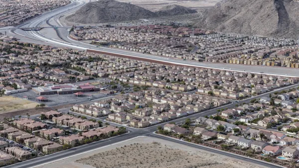
Is There an Environmentalist Case for Sprawl?
Yes, sprawl is still bad for the environment.
Concerns Over Tolls and Sprawl May Determine Bridge Width
Plans for a new bridge over the Columbia River in Oregon have local officials in a debate over lanes, tolls and sprawl.
Bridge Expansion Plans Ignore Effects of Growth
Plans to build a new bridge over the Columbia River in Portland ignored projections that said the newer, bigger bridge would contribute to outward expansion of development from the metropolitan core.

Planetizen Federal Action Tracker
A weekly monitor of how Trump’s orders and actions are impacting planners and planning in America.

Eastern Nebraska is running out of electricity
Data centers and electrification are straining eastern Nebraska’s grid, throttling economic development.

Study reveals best places in the U.S. for cycling, walking
New research from Streetlight Data examines bicycle and pedestrian miles per capita in the 100 largest U.S. cities by population.

DSA members accuse Mamdani of 'abandoning values' over housing redevelopment
New York City's mayor plans to replace about 2,000 units of public housing with private, mixed-income housing.

All sides of BRT debate unhappy with CDOT’s most recent move
The Colorado Department of Transportation is no longer considering center-running bus lanes for Colorado Boulevard.

Massachusetts bogs generate both power, and cranberries
Putting solar panels above farmland is one way Massachusetts is advancing toward its goal of net-zero carbon emissions by 2050.

FREE Course: Walkable City 1: Why Walkability?
After describing his path towards focusing on walkability as the essence of good planning, Jeff Speck marches through his five principal reasons for making more walkable places.
Reinventing Malls: Planning Alchemy—Turning Gray Fields Into Gold
The course focuses on the opportunities and imperatives that shape reinvention of mall sites.

City of Rosemead
Rutgers University, Edward J. Bloustein School of Planning and Public Policy
One Hundred Miles
University of Michigan School for Environment and Sustainability (SEAS)
Hunter College, City University of New York (CUNY)
The Architects Foundation
City of Cambridge
The Pocatello Development Authority
The Urban Renewal Agency of the City of Pocatello