


What motivates sprawl? It's more than just automobile infrastructure.

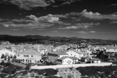
I have a mental conception of what sprawl looks like: mostly air with vinyl exoskeleton and asphalt driveways—the ubiquitous 'burbs. Professor Michael Lewyn listed some of its agents in his recent piece for Planetizen, "How to Teach About Sprawl (and Law)." He primarily focuses on the usual spatial suspects: wide (too wide) streets and lots for (too) big houses. In this picture sprawl is largely associated with the 'burbs and big box stores, an "inefficient" use of land. Here I'll go into what enables the spatial actants.
In his book, All Over the Map, architect Michael Sorkin critically explores some of the agents that give cities their form. He asks us to look beyond the architecture of cities and inquire into the complex histories of them. In his essay exploring the physical and figurative Manhattan crater of 9/11 he writes, "The suburbs were fertilized by massive government intervention in highway construction, by radical tax policy, by changes in the national culture of desire, by racism, by cheap, unencumbered land, and by an earlier fear of terror."
Sprawl isn't simply design standards that require wasting land—for example, driving lanes that are substantially wider than vehicles, surface parking lot built to meet Christmas shopping peak demand, or McMansions that waste land (as much as they do air)—but something more holistic and nuanced. Sprawl is a socio-political-economic web complexly intertwined and interconnected, often messily and incomprehensibly but sometimes parsed by the bright ones scraping away the surface for deeper explorations.
As Sorkin writes, the fear of a terror attack induced policies for de-densification. Where we lived and worked needed to be designed to make for quick evacuations. The prospect of nuclear annihilation made urban concentrations particularly vulnerable. As GlobalSecurity.org reveals,
When President Eisenhower went to Kansas to announce the interstate highway system, he announced it as “the National Defense Highway System.” In 1956 [he] signed legislation establishing the National System of Interstate and Defense Highways (about 41,000 miles of roads). Since then, [Department of Defense] has continued to identify and update defense-important highway routes. The National Defense Highway system was designed to move military equipment and personnel efficiently.
Of course, The National Defense Highway ensured transportation routes was good for the automobile industry too. The massive de-urbanization in Maoist China was also the direct result of nuclear anxiety, Sorkin reminds us.
The typical dialectic of city versus suburb, however, is operationally meaningless when we explore a finer resolution for sprawl's agents: Our personal desire for a chunk of land, and the dominant mode of transportation that takes us from property chunk to property chunk; technologies that problematize the need to be a pedestrian to access businesses (the market-place ballet has been scrubbed by clicking and purchasing via intertubes).
There's also the financial system's need to sprawl. Capital ultimately gets laid down in bricks and mortar. Capital is any asset that generates a financial return. Real estate is physical capital, a place where money becomes something physical to earn a rate of return. Financially diagnosed cheap farm land, aided by government incentives, makes for a good return on investment. (The housing market in London or Vancouver isn't much interested in supplying a housing stock for its population, but that's another story.)
What we build is not detached from nature; it's getting laid down in the geological strata, which is amazingly disturbing. But I'll look at the Anthropocene epoch, and problematize it, in a future post. In brief, yes, sprawl is bad, and we need to explore and ultimately resist its agents. We live in an ecological system where we can't fully know how much damage we can do to it before it collapses. When we starting thinking about the complex mosaic of sprawl we begin to see its puppeteers. Don't be a puppet.
Connect with Steven on Twitter @stevenpsnell or Facebook stevenpsnell. Download his novel, Clear Running Water, at Smashwords.


Does Suburbia Promote Fertility?
In Joel Kotkin's new book The Human City, he argues that suburbanization promotes higher birthrates. But this policy doesn't seem to have worked so far.

Planetizen Federal Action Tracker
A weekly monitor of how Trump’s orders and actions are impacting planners and planning in America.

Canada vs. Kamala: Whose Liberal Housing Platform Comes Out on Top?
As Canada votes for a new Prime Minister, what can America learn from the leading liberal candidate of its neighbor to the north?

The Five Most-Changed American Cities
A ranking of population change, home values, and jobs highlights the nation’s most dynamic and most stagnant regions.

San Diego Adopts First Mobility Master Plan
The plan provides a comprehensive framework for making San Diego’s transportation network more multimodal, accessible, and sustainable.

Housing, Supportive Service Providers Brace for Federal Cuts
Organizations that provide housing assistance are tightening their purse strings and making plans for maintaining operations if federal funding dries up.

Op-Ed: Why an Effective Passenger Rail Network Needs Government Involvement
An outdated rail network that privileges freight won’t be fixed by privatizing Amtrak.
Urban Design for Planners 1: Software Tools
This six-course series explores essential urban design concepts using open source software and equips planners with the tools they need to participate fully in the urban design process.
Planning for Universal Design
Learn the tools for implementing Universal Design in planning regulations.
New York City School Construction Authority
Village of Glen Ellyn
Central Transportation Planning Staff/Boston Region MPO
Institute for Housing and Urban Development Studies (IHS)
City of Grandview
Harvard GSD Executive Education
Regional Transportation Commission of Southern Nevada
Toledo-Lucas County Plan Commissions