A new Canadian company has matched GPS-coordinated street-level camcorder shots of Toronto with mapping software to enable a real-life horizontal view of any coordinate, allowing users to preview a destination before visiting.
"A Toronto-based start-up called VirtualCity is taking a stab at the art of street-mapping, and the results are eye-opening.
The idea is simple, if ambitious: to provide street-level side-on view of an entire city, keyed to an overhead map. When a user clicks on a street location, VirtualCity brings up a photo of what she would see if she was actually standing there, looking at the buildings on either side of the road.
It works surprisingly well. You can navigate using the overhead map or by punching a street address into the search bar (though the site sometimes gets confused between "east" and "west" streets, like King Street East and King Street West). And once you're looking at a street in elevation - VirtualCity provides thumbnails of both sides of the road - you can "stroll" down the street in either direction.
The results are really something, but for an unexpected reason. Unlike the distant satellite images that Google Maps uses, whose vast scope musters a sense of awe, VirtualCity's photos are more like day-in-the-life snapshots. Pedestrians walk the sidewalks. Streetcars and fire trucks obscure edges of the frame. You can see the detritus on front porches, recycling in the alleys, cars parked on the margins and the tail ends of streetcars retreating out of view. It's a celebration of the urban mundane.
The hope, according to the company, is that the service will catch on with Internet users who want to preview a destination before going. It's not hard to imagine the site's uses: You could use it to visualize the restaurant you're supposed to meet a friend at before you leave the front door. Should the service make good on its plans to cover residential areas, it would prove a godsend for house-hunters. And, with such a wealth of content, it's bound to attract an audience of virtual tourists."
FULL STORY: VirtualCity delivers the real thing

Planetizen Federal Action Tracker
A weekly monitor of how Trump’s orders and actions are impacting planners and planning in America.

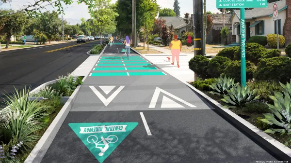
Silicon Valley ‘Bike Superhighway’ Awarded $14M State Grant
A Caltrans grant brings the 10-mile Central Bikeway project connecting Santa Clara and East San Jose closer to fruition.

Amtrak Cutting Jobs, Funding to High-Speed Rail
The agency plans to cut 10 percent of its workforce and has confirmed it will not fund new high-speed rail projects.

Oregon Approves Ambitious Framework for ’Microgrids’
Local energy “islands” within the larger power system ensure key facilities can remain online during emergencies and power outages.

A Historic Investment in LA County’s Parks and Open Spaces
Los Angeles County has launched its largest-ever competitive grant program, investing $58 million to expand park access, enhance climate resilience, and support community-driven projects in the areas that need them most.

San Diego Wins $14M for Affordable Housing
The funding comes via the state’s Regional Early Action Planning program and will help create close to 1,000 new housing units.
Urban Design for Planners 1: Software Tools
This six-course series explores essential urban design concepts using open source software and equips planners with the tools they need to participate fully in the urban design process.
Planning for Universal Design
Learn the tools for implementing Universal Design in planning regulations.
Caltrans
City of Fort Worth
New Jersey Institute of Technology
Mpact (founded as Rail~Volution)
City of Camden Redevelopment Agency
City of Portland
City of Laramie


