Form-based zoning focuses on the design of buildings and how they interact with the public realm.


Arlington, Texas is testing a new form-based zoning code that, unlike traditional zoning, focuses on the design of buildings and how they interact with surrounding public space, offering more options for uses.
As Billy Wadsack explains in Bisnow, “The form-based zoning code being piloted in the area is designed to create walkable neighborhoods by regulating how buildings, streets and public spaces work together.”
The new code divides downtown Arlintgon into five districts: “traditional neighborhood, urban neighborhood, corridor mixed-use, downtown core and a downtown gateway special district.” Each zone will allow progressively higher density and more diverse uses. “The downtown core area will allow mid-rise buildings that top out at 12 stories for uses such as hotels, offices, residential, civic and entertainment. And the downtown gateway will feature mid- and high-rise buildings up to 18 stories for uses like hotels, offices, residential, and sports and entertainment attractions.”
The new code also regulates sidewalk widths, building setbacks, and the distance between structures. “Arlington's planning and zoning committee is scheduled to hold a public hearing on the form-based zoning plan in March, and the council will discuss it again that same month.”
Read the full story: Arlington Seeks To Reimagine Downtown Through Form-Based Zoning


Rural New York Explores Creative Housing Solutions
Rural communities and small cities are implementing affordable housing solutions at the local level, while the state budget prioritizes urban areas.

Seattle Downtown Plan Expands Permitted Uses
The Downtown Activation Plan shifts from Euclidean to form-based zoning to encourage more commercial development.
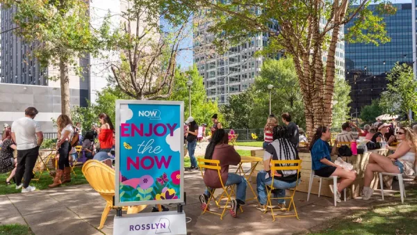
Arlington's 'pop-up park' activates a vacant plaza
Third spaces don't have to be permanent.

Planetizen Federal Action Tracker
A weekly monitor of how Trump’s orders and actions are impacting planners and planning in America.

California plans to bury El Niño’s downpour
If the state plays its cards right, it may be able to store a billion acre-feet of El Niño’s water in aquifers.

Chicago breaks ground on $3 billion megadevelopment
The new neighborhood, titled Foundry Park, will one day host 3,700 residences.

Satanic place names
From streams and lakes to valleys and canyons, I mapped more than 1,000 places named after the Devil.

California High-Speed Rail Authority CEO resigns after $600,000 scandal
Under Ian Choudri, the authority used taxpayer dollars to fund first class flights and trips to nightclubs.

Want to study the Missouri River? Soon, you may need unanimous approval from 10 states
Legislation would require 10 governors’ permission to study or build projects moving water outside the basin.

FREE Course: Walkable City 1: Why Walkability?
After describing his path towards focusing on walkability as the essence of good planning, Jeff Speck marches through his five principal reasons for making more walkable places.
Reinventing Malls: Planning Alchemy—Turning Gray Fields Into Gold
The course focuses on the opportunities and imperatives that shape reinvention of mall sites.

City of Rosemead
Rutgers University, Edward J. Bloustein School of Planning and Public Policy
One Hundred Miles
Hunter College, City University of New York (CUNY)
The Architects Foundation
University of Cincinnati Online
City of Cambridge
Montrose County
The Pocatello Development Authority