


A recent trend in returning the use of streets and other public space to the use of humans and other modes of transportation other than the car is more striking with some historical perspective.
A recent trend in returning the use of streets and other public space to the use of humans and other modes of transportation other than the car is more striking with some historical perspective.
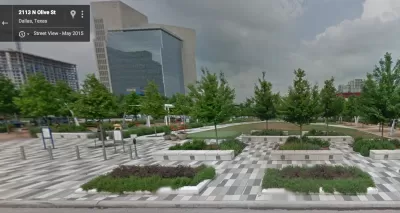
Melia Robinson shares 41 examples of public space makeovers around the world—curated by a Brazilian urban planning collective called Urb-i. The team at Urb-I scoured Google Street View, for examples of public spaces remade for humans, rather than cars. Examples from the United States include Klyde Warren Park in Dallas, Times Square in New York City, a "People St." in the Silver Lake neighborhood of Los Angeles, Atwater Street in Detroit, and Coenties Slip and Dutch Kills Green in New York City.
Robinson shares 41 examples, but the Urb-I team has produced more than 300 public space transformations from around the world.
FULL STORY: 41 amazing public space transformations captured by Google Street View

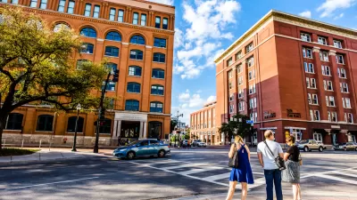
A New Vision for Dallas’ Dealey Plaza
After decades of neglect, a team of designers reimagines the infamous plaza as a safe, vibrant, multimodal public space.
Rethinking Streets During the Pandemic
A new book from the "Rethinking Streets" series identifies 25 quick redesigns cities can use to reconfigure streets for the realities of the COVID-19 pandemic.
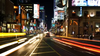
Pedestrian-Friendly Makeover of a Busy Toronto Street Stops Short of the Car-Free Ideal
The yongeTOmorrrow project is heading toward the finish line with widespread support from advocates, but a few want the plan to go one step further.

Trump Administration Could Effectively End Housing Voucher Program
Federal officials are eyeing major cuts to the Section 8 program that helps millions of low-income households pay rent.

Planetizen Federal Action Tracker
A weekly monitor of how Trump’s orders and actions are impacting planners and planning in America.

Ken Jennings Launches Transit Web Series
The Jeopardy champ wants you to ride public transit.

Driving Equity and Clean Air: California Invests in Greener School Transportation
California has awarded $500 million to fund 1,000 zero-emission school buses and chargers for educational agencies as part of its effort to reduce pollution, improve student health, and accelerate the transition to clean transportation.

Congress Moves to End Reconnecting Communities and Related Grants
The House Transportation and Infrastructure Committee moved to rescind funding for the Neighborhood Equity and Access program, which funds highway removals, freeway caps, transit projects, pedestrian infrastructure, and more.

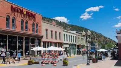
From Throughway to Public Space: Taking Back the American Street
How the Covid-19 pandemic taught us new ways to reclaim city streets from cars.
Urban Design for Planners 1: Software Tools
This six-course series explores essential urban design concepts using open source software and equips planners with the tools they need to participate fully in the urban design process.
Planning for Universal Design
Learn the tools for implementing Universal Design in planning regulations.
Heyer Gruel & Associates PA
Ada County Highway District
Institute for Housing and Urban Development Studies (IHS)
City of Grandview
Harvard GSD Executive Education
Toledo-Lucas County Plan Commissions
Salt Lake City
NYU Wagner Graduate School of Public Service