


Researchers from Weill Cornell Medical College have spent the last 18 months scouring the New York Subway in the search for a DNA profile of the system. They even created a map of the 15,152 microbes they found.
If you think of New York City as a place where anything can happen, you probably weren't thinking that contracting Bubonic Plague from a handrail at a subway stop as one of them. But researchers from Weill Cornell Medical College recently set out to map the kind of microbes they found in the New York Subway as part of an intensive research project combining "big data," public health, and public transit.
Robert Lee Holtz reports on the project for the Wall Street Journal (which means there might be a paywall blocking access to the story): "The big-data project, the first genetic profile of a metropolitan transit system, is in many ways 'a mirror of the people themselves who ride the subway,' said Dr. Mason, a geneticist at the Weill Cornell Medical College."
Meghan Holohan also covers the study for NBC News. According to Holohan, "Weill Cornell researchers attempted to identify all 15,152 microbes for a PathoMap, which could be used to track infectious disease outbreaks."
Andrew M. Seaman also covered the story for Reuters.
Lastly, Science Daily also has an abstract detailing the methodology and some of the findings of the study.

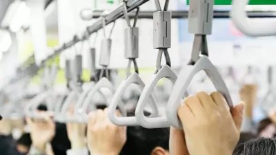
Mapping the World of Bacteria Alive in the World's Subways
A project launched several years ago in New York City is making its way to cities around the world—much like the bacteria that the world's billions of transit users transfer around the surfaces of subway trains, stations, and buses.
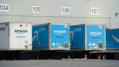
Poorest NYC Neighborhoods Pay Price for Delivery Boom
The rise of ‘last-mile’ e-commerce warehouses — and their attendant truck traffic and air pollution — is disproportionately impacting the most historically disadvantaged parts of the city.
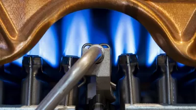
Study: Building Pollution Contributing to Poor Air Quality in NYC
Pollutants from methane, propane, and fuel oil are on the rise, leading to a growing public health crisis.

Planetizen Federal Action Tracker
A weekly monitor of how Trump’s orders and actions are impacting planners and planning in America.

San Francisco's School District Spent $105M To Build Affordable Housing for Teachers — And That's Just the Beginning
SFUSD joins a growing list of school districts using their land holdings to address housing affordability challenges faced by their own employees.

The Tiny, Adorable $7,000 Car Turning Japan Onto EVs
The single seat Mibot charges from a regular plug as quickly as an iPad, and is about half the price of an average EV.

Seattle's Plan for Adopting Driverless Cars
Equity, safety, accessibility and affordability are front of mind as the city prepares for robotaxis and other autonomous vehicles.

As Trump Phases Out FEMA, Is It Time to Flee the Floodplains?
With less federal funding available for disaster relief efforts, the need to relocate at-risk communities is more urgent than ever.

With Protected Lanes, 460% More People Commute by Bike
For those needing more ammo, more data proving what we already knew is here.
Urban Design for Planners 1: Software Tools
This six-course series explores essential urban design concepts using open source software and equips planners with the tools they need to participate fully in the urban design process.
Planning for Universal Design
Learn the tools for implementing Universal Design in planning regulations.
Smith Gee Studio
City of Charlotte
City of Camden Redevelopment Agency
City of Astoria
Transportation Research & Education Center (TREC) at Portland State University
US High Speed Rail Association
City of Camden Redevelopment Agency
Municipality of Princeton (NJ)