


Pedestrian safety in Philadelphia is a mixed bag. While it can often be a pleasant, pedestrian-friendly city, recent pedestrian deaths have highlighted the ongoing need to improve the safety of the Philadelphia's sidewalks and streets.
"Philadelphia likes to think of itself as a pedestrian-friendly place, with good sidewalks and short, lively blocks, and yet its safety record for pedestrians still leaves something to be desired," writes Philadelphia Inquirer Architecture Critic Inga Saffron.
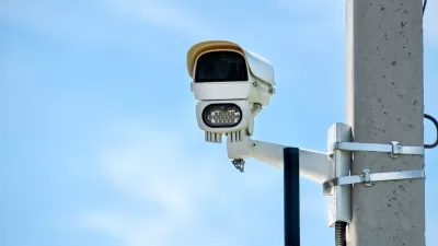
"On one hand, Philadelphia came in fourth nationally in this year's Walk Score rankings. Thanks to new countdown signals at intersections, fresh striping at crosswalks, and traffic cameras to deter speeding, crashes involving pedestrians have dropped 10 percent since 2007."
"But pedestrian fatalities in Philadelphia still account for a far higher proportion of traffic deaths than they do elsewhere in the United States: 32 percent here vs. 14 percent nationally. Philadelphia has the highest number of pedestrian fatalities of any county in Pennsylvania, and the total rose by three in 2013, to 37, according to the National Highway Traffic Safety Administration."
Saffron assigns some of the blame to planning policies as well as the lack of organization among pedestrians, but notes that the city's police have recognized pedestrian safety as a quality of life issue and are stepping up enforcement by means other than writing jaywalking tickets.
The post also includes a list of the ten corridors in Philadelphia that had the most pedestrian-involved accidents.
FULL STORY: Changing Skyline: Pedestrian safety is becoming a focus

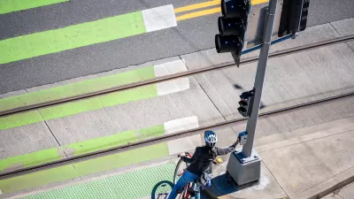
Philly Speed Camera Program Cuts Fatalities in Half
Excessive speeding along dangerous segments of Roosevelt Boulevard dropped by 90 percent after the city installed automated enforcement cameras.
Audit: Portland’s Vision Zero Needs More Data, Funding
A city audit found that the program has failed to reduce traffic deaths and could benefit from a more systematic approach. Meanwhile, PBOT says it needs more state funding to support road safety projects.

Banning Right Turns on Red Just One Step Toward Vision Zero
Experts caution that blanket bans on right turns on red make only a slight contribution to reducing fatal crashes, and other interventions are needed to bring down traffic fatalities.

Planetizen Federal Action Tracker
A weekly monitor of how Trump’s orders and actions are impacting planners and planning in America.

Map: Where Senate Republicans Want to Sell Your Public Lands
For public land advocates, the Senate Republicans’ proposal to sell millions of acres of public land in the West is “the biggest fight of their careers.”

Restaurant Patios Were a Pandemic Win — Why Were They so Hard to Keep?
Social distancing requirements and changes in travel patterns prompted cities to pilot new uses for street and sidewalk space. Then it got complicated.

Platform Pilsner: Vancouver Transit Agency Releases... a Beer?
TransLink will receive a portion of every sale of the four-pack.

Toronto Weighs Cheaper Transit, Parking Hikes for Major Events
Special event rates would take effect during large festivals, sports games and concerts to ‘discourage driving, manage congestion and free up space for transit.”

Berlin to Consider Car-Free Zone Larger Than Manhattan
The area bound by the 22-mile Ringbahn would still allow 12 uses of a private automobile per year per person, and several other exemptions.
Urban Design for Planners 1: Software Tools
This six-course series explores essential urban design concepts using open source software and equips planners with the tools they need to participate fully in the urban design process.
Planning for Universal Design
Learn the tools for implementing Universal Design in planning regulations.
Heyer Gruel & Associates PA
JM Goldson LLC
Custer County Colorado
City of Camden Redevelopment Agency
City of Astoria
Transportation Research & Education Center (TREC) at Portland State University
Camden Redevelopment Agency
City of Claremont
Municipality of Princeton (NJ)