


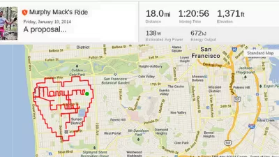
The same week that the New York Police Department released a boat load of data about traffic collisions comes news that exercise app Strava will sell its data on the how, where, and when bikers and runners use streets.
"On Wednesday, the San Francisco-based company launched Strava Metro, which provides data from 90 million bike rides and 24 million runs as of this week — the byproduct of virtual competitions around the world — to help urban planners understand how and where cyclists use public streets," reports Reed Albergotti.
"The first customer, Oregon’s Department of Transportation, is paying $20,000 to use the data for a year. Strava also signed up London; Glasgow; Orlando, Fla.; and Alpine Shire in Victoria, Australia."
Albergotti cites an anecdote shared by Margi Bradway, a policy analyst for the Oregon DOT, who discovered that her friends would use the app even more if they knew planners were using it to make data-driven decisions. In fact, "[in] the past six months, Oregon has used the Strava data to determine where cyclists have trouble figuring out traffic patterns, and to find the best way to install rumble strips on a road outside Portland that is popular with cyclists."
FULL STORY: Strava, Popular With Cyclists and Runners, Wants to Sell Its Data to Urban Planners

Fitness Apps Are the New Planning Tool
Many smartphone users have a fitness app that they use to track their routes and progress on fitness goals. The data in these apps is a gold mine for planners, helping lead to better infrastructure investments.

There's No App for Silver Bullets
Two planning researchers, one a professor at Tufts and another independent, make the case against apps as a panacea for urban problems.
Transitmix Finds Professional Applications, Municipal Partners
Transitmix, an online tool for sketching out and testing fantasy transit routes, has evolved beyond its original mass appeal to become a trusted tool for transportation planners around the country.

Trump Administration Could Effectively End Housing Voucher Program
Federal officials are eyeing major cuts to the Section 8 program that helps millions of low-income households pay rent.

Planetizen Federal Action Tracker
A weekly monitor of how Trump’s orders and actions are impacting planners and planning in America.

Ken Jennings Launches Transit Web Series
The Jeopardy champ wants you to ride public transit.

Driving Equity and Clean Air: California Invests in Greener School Transportation
California has awarded $500 million to fund 1,000 zero-emission school buses and chargers for educational agencies as part of its effort to reduce pollution, improve student health, and accelerate the transition to clean transportation.

Congress Moves to End Reconnecting Communities and Related Grants
The House Transportation and Infrastructure Committee moved to rescind funding for the Neighborhood Equity and Access program, which funds highway removals, freeway caps, transit projects, pedestrian infrastructure, and more.

From Throughway to Public Space: Taking Back the American Street
How the Covid-19 pandemic taught us new ways to reclaim city streets from cars.
Urban Design for Planners 1: Software Tools
This six-course series explores essential urban design concepts using open source software and equips planners with the tools they need to participate fully in the urban design process.
Planning for Universal Design
Learn the tools for implementing Universal Design in planning regulations.
Heyer Gruel & Associates PA
Ada County Highway District
Institute for Housing and Urban Development Studies (IHS)
City of Grandview
Harvard GSD Executive Education
Toledo-Lucas County Plan Commissions
Salt Lake City
NYU Wagner Graduate School of Public Service