


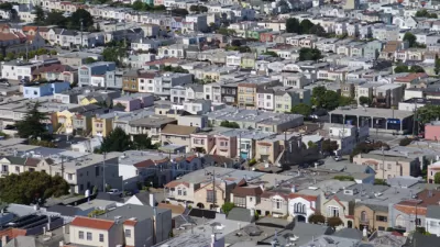
Despite its mostly sprawling conditions, San Jose has recently prioritized walkable, dense urban environments. But should the city focus its development downtown or build a connected network of urban neighborhoods?
Urbanists are keeping a close eye on the development prospects of San Jose in the Silicon Valley. The sprawling city has, in recent years, attempted to overcome its suburban development patterns, “[shifting] its strategic focus to increasingly dense, urban development, implementing a downtown high-rise incentive program, fast-tracking new residential towers and adding citywide bike lanes,” writes Lauren Hepler.
New development possibilities outside of Downtown, however, stir controversy among Downtown stakeholders who would like to concentrate development in the core. The controversy was given new fuel at the hint of large-scale development plans in a section of town called Santana Row. In an earlier article, Hepler details the deal creating the consternation: “The owner of the San Jose shopping and socializing hub, Maryland-based Federal Realty Investment Trust, Wednesday said it has entered ‘a long-term’ land lease for the 11.6-acre Century Theatres site located just across Winchester Boulevard from Santana Row.”
The possibilities seem in line with the urban ambitions of the city, “[but] any new development would likely run into old criticisms; Santana Row's location outside of downtown San Jose has always been a sticking point for advocates of more centralized urban development,” explains Halpern in the later article.
Others, however, argue that San Jose can have more than one focal point of development. Even the august observer SPUR argued for the city “to better link and promote areas surrounding downtown, like the Alameda, Japantown, Santana Row and Willow Glen,” in a recent report on San Jose. Hepler quotes the report, which says the city should "reframe the surrounding areas as an asset to downtown, not a threat."
FULL STORY: The Santana Row conundrum: Is San Jose's future urban density, suburban sprawl or both?


Can Urbanist Islands Make a Difference Where Sprawl Reigns?
The product of a single developer, San Jose's Santana Row is a pocket of urbanism in a sea of sprawl. But can it influence development patterns beyond its bounds, and should it?

Pedestrian-Friendly Malls Continue to Gain Popularity
Providence, Rhode Island is one of many cities to get mall-like retail center built with walkability in mind and set around a Plaza.
SPUR: The Bay Area Has A Sprawl Problem
SPUR states its case clearly by announcing, “We believe cities are the key to our future” at the opening of a new report called “SPUR’s Agenda for Change.”

Planetizen Federal Action Tracker
A weekly monitor of how Trump’s orders and actions are impacting planners and planning in America.

Map: Where Senate Republicans Want to Sell Your Public Lands
For public land advocates, the Senate Republicans’ proposal to sell millions of acres of public land in the West is “the biggest fight of their careers.”

Restaurant Patios Were a Pandemic Win — Why Were They so Hard to Keep?
Social distancing requirements and changes in travel patterns prompted cities to pilot new uses for street and sidewalk space. Then it got complicated.

Platform Pilsner: Vancouver Transit Agency Releases... a Beer?
TransLink will receive a portion of every sale of the four-pack.

Toronto Weighs Cheaper Transit, Parking Hikes for Major Events
Special event rates would take effect during large festivals, sports games and concerts to ‘discourage driving, manage congestion and free up space for transit.”

Berlin to Consider Car-Free Zone Larger Than Manhattan
The area bound by the 22-mile Ringbahn would still allow 12 uses of a private automobile per year per person, and several other exemptions.
Urban Design for Planners 1: Software Tools
This six-course series explores essential urban design concepts using open source software and equips planners with the tools they need to participate fully in the urban design process.
Planning for Universal Design
Learn the tools for implementing Universal Design in planning regulations.
Heyer Gruel & Associates PA
JM Goldson LLC
Custer County Colorado
City of Camden Redevelopment Agency
City of Astoria
Transportation Research & Education Center (TREC) at Portland State University
Camden Redevelopment Agency
City of Claremont
Municipality of Princeton (NJ)