


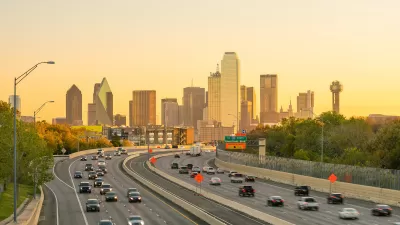
Analysis of the USDA’s 2010 National Resources Inventory, which tracks land use, shows the growth rate of suburban sprawl peaking in the mid-1990s, declining by two-thirds since then, even through the most recent housing boom. How did that happen?
Payton Chung provides new analysis of the USDA’s 2010 National Resources Inventory that shows sprawl beginning to slow in the mid-1990s and continuing to slow ever since. The findings don't indicate that sprawl is over, just that it's not expanding as quickly as it did in the past. The "inflection point," or the moment the rate of sprawl began to decrease, occurred perhaps earlier than many realized. As pointed out by Chung, peak sprawl also "predated 'peak car' by 10-15 years."
As for why peak sprawl occurred in the 1990s, Chung speculates: "the 1980s cessation of massive freeway construction may have pushed many metro areas into some version of Marchetti's Wall: the theory that people don't want to travel more than one hour a day, and thus that metropolitan growth has geometric limits tied to how far the predominant mode of travel goes."
Chung also notes that some of the consequences of sprawl, like Vehicle Miles Traveled, will be impacted by the slowing rate of outward growth. "A majority of the VMT benefits from more-central locations come from the fact that destinations are closer and car trips are shorter; only a minority of the benefits come from a switch to other modes. As growth recentralizes, perhaps VMT can be expected to decline further."
FULL STORY: As it turns out, suburban sprawl actually peaked 20 years ago

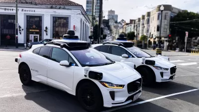
How Autonomous Cars Can Induce Sprawl and Sabotage Climate Goals
Robotaxis can lead to longer, more frequent trips and are projected to increase VMT by as much as 83 percent.

Opinion: Why Linking Driving to GDP Misses the Point
The argument that car-centric development is good because it boosts national GDP ignores the massive costs of driving to everyday Americans.
How to Reduce Excess Vehicle Travel
Some experts claim that remote work is the most effective way to reduce vehicle travel, but my research indicates that improving and encouraging walking, bicycling, and public transit can provide larger impacts and benefits.

Planetizen Federal Action Tracker
A weekly monitor of how Trump’s orders and actions are impacting planners and planning in America.

Map: Where Senate Republicans Want to Sell Your Public Lands
For public land advocates, the Senate Republicans’ proposal to sell millions of acres of public land in the West is “the biggest fight of their careers.”

Restaurant Patios Were a Pandemic Win — Why Were They so Hard to Keep?
Social distancing requirements and changes in travel patterns prompted cities to pilot new uses for street and sidewalk space. Then it got complicated.

Platform Pilsner: Vancouver Transit Agency Releases... a Beer?
TransLink will receive a portion of every sale of the four-pack.

Toronto Weighs Cheaper Transit, Parking Hikes for Major Events
Special event rates would take effect during large festivals, sports games and concerts to ‘discourage driving, manage congestion and free up space for transit.”

Berlin to Consider Car-Free Zone Larger Than Manhattan
The area bound by the 22-mile Ringbahn would still allow 12 uses of a private automobile per year per person, and several other exemptions.
Urban Design for Planners 1: Software Tools
This six-course series explores essential urban design concepts using open source software and equips planners with the tools they need to participate fully in the urban design process.
Planning for Universal Design
Learn the tools for implementing Universal Design in planning regulations.
Heyer Gruel & Associates PA
JM Goldson LLC
Custer County Colorado
City of Camden Redevelopment Agency
City of Astoria
Transportation Research & Education Center (TREC) at Portland State University
Camden Redevelopment Agency
City of Claremont
Municipality of Princeton (NJ)