


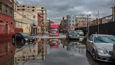
In bright blues, greens, and reds, an interactive map developed by property information website Property Shark documents New York City's cornucopia of polluted properties. Check the map to see if you might be living next door to a leaking oil tank.
"Take one look at this interactive map of New York City’s toxic sites, and the city appears to be one giant minefield loaded with brownfields, superfund sites, and gas tank leaks galore," writes Sydney Brownstone. "But the toxic spills littering the scene make up more than just a map: They tell a cautionary tale about the history of development in the city."
“It’s sort of daunting when you look at the map really zoomed out. You see all these colors and icons and you’re like, ‘Oh my god, do I really want to live in New York City?’” said Nancy Jorisch, a senior data analyst at Property Shark. “But of course you do. Because when you really, really zoom in, you realize that those icons tend to be clustered in certain areas. And where there’s the occasional icon, there’s a bunch of them that are coming from zoning changes, and the need to repurpose property in New York,” she added.
FULL STORY: New York City’s (Many) Toxic Sites, Mapped For Your Avoidance Convenience

Nearly Half of New York City Burdened by Pollution
Communities of color make up the majority of people harmed by pollution, as well as heat and flooding, says the study, which is New York City’s first comprehensive survey of environmental injustices.

A Toxic Legacy in an Orange County Neighborhood
The contaminated soil and neglected infrastructure in Santa Ana's Barrio Logan community are a result of decades of land use decisions and willful disinvestment, one journalist writes.

Soaking-Up New York's Filthy Water With a Sponge Park
A 2,100 square foot park on the banks of New York City's Gowanus Canal is part of a plan to catch pollutants from storm off from draining into the already polluted waterway.

Maui's Vacation Rental Debate Turns Ugly
Verbal attacks, misinformation campaigns and fistfights plague a high-stakes debate to convert thousands of vacation rentals into long-term housing.

Planetizen Federal Action Tracker
A weekly monitor of how Trump’s orders and actions are impacting planners and planning in America.

San Francisco Suspends Traffic Calming Amidst Record Deaths
Citing “a challenging fiscal landscape,” the city will cease the program on the heels of 42 traffic deaths, including 24 pedestrians.

Defunct Pittsburgh Power Plant to Become Residential Tower
A decommissioned steam heat plant will be redeveloped into almost 100 affordable housing units.

Trump Prompts Restructuring of Transportation Research Board in “Unprecedented Overreach”
The TRB has eliminated more than half of its committees including those focused on climate, equity, and cities.

Amtrak Rolls Out New Orleans to Alabama “Mardi Gras” Train
The new service will operate morning and evening departures between Mobile and New Orleans.
Urban Design for Planners 1: Software Tools
This six-course series explores essential urban design concepts using open source software and equips planners with the tools they need to participate fully in the urban design process.
Planning for Universal Design
Learn the tools for implementing Universal Design in planning regulations.
Heyer Gruel & Associates PA
JM Goldson LLC
Custer County Colorado
City of Camden Redevelopment Agency
City of Astoria
Transportation Research & Education Center (TREC) at Portland State University
Jefferson Parish Government
Camden Redevelopment Agency
City of Claremont