


Imagine being able to traverse a major city surrounded entirely by bikes, pedestrians, and green spaces. That vision is poised to become reality in Hamburg within the next two decades as the city pursues plans for a vast Grünes Netz (Green Network).
"Welcome to Hamburg, an environmental pioneer in the mould of its regional neighbour Copenhagen," writes Elisabeth Braw. "Its planned green network will cover 40% of the city's area."
"'It will connect parks, recreational areas, playgrounds, gardens and cemeteries through green paths', Angelika Fritsch, a spokeswoman for the city's department of urban planning and the environment, tells Guardian Sustainable Business. 'Other cities, including London, have green rings, but the green network will be unique in covering an area from the outskirts to the city centre. In 15 to 20 years you'll be able to explore the city exclusively on bike and foot.'"
"Perhaps more importantly, the network will absorb CO2 emissions and help prevent floods when inevitable superstorms strike," adds Braw.
Thanks to Fast Company Co.Exist
FULL STORY: Hamburg's answer to climate change


Living With Flooding in a German Port Town
A riverside neighborhood in Hamburg embraces flooding as part of its resilience planning, using old techniques to protect modern communities.

Watch: The Car-Free City Becomes Reality
The latest City Beautiful video shows off the fruits of car-free initiatives in European cities.
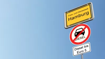
More Diesel Driving Bans Coming to German Cities
Germany's automotive industry and Chancellor Angela Merkel are increasingly worried about the economic effects of court-sanctioned diesel driving bans to improve air quality, as enacted in Hamburg last May. Four more cities are likely to enact bans.

Planetizen Federal Action Tracker
A weekly monitor of how Trump’s orders and actions are impacting planners and planning in America.

Congressman Proposes Bill to Rename DC Metro “Trump Train”
The Make Autorail Great Again Act would withhold federal funding to the system until the Washington Metropolitan Area Transit Authority (WMATA), rebrands as the Washington Metropolitan Authority for Greater Access (WMAGA).

DARTSpace Platform Streamlines Dallas TOD Application Process
The Dallas transit agency hopes a shorter permitting timeline will boost transit-oriented development around rail stations.

Renters Now Outnumber Homeowners in Over 200 US Suburbs
High housing costs in city centers and the new-found flexibility offered by remote work are pushing more renters to suburban areas.

The Tiny, Adorable $7,000 Car Turning Japan Onto EVs
The single seat Mibot charges from a regular plug as quickly as an iPad, and is about half the price of an average EV.

Supreme Court Ruling in Pipeline Case Guts Federal Environmental Law
The decision limits the scope of a federal law that mandates extensive environmental impact reviews of energy, infrastructure, and transportation projects.
Urban Design for Planners 1: Software Tools
This six-course series explores essential urban design concepts using open source software and equips planners with the tools they need to participate fully in the urban design process.
Planning for Universal Design
Learn the tools for implementing Universal Design in planning regulations.
Municipality of Princeton
Roanoke Valley-Alleghany Regional Commission
City of Mt Shasta
City of Camden Redevelopment Agency
City of Astoria
Transportation Research & Education Center (TREC) at Portland State University
US High Speed Rail Association
City of Camden Redevelopment Agency
Municipality of Princeton (NJ)