


The half-mile circle has become the standard metric for focusing planning efforts and judging the impacts of transit-oriented development. A new study examines whether the half-mile circle is an effective predictor of TOD success.
"Planners and researchers use transit catchment areas—the land around stations—as geographic units for predicting ridership, assessing the impacts of transit investments and, recently, for designing transit-oriented developments (TODs)," explain Erick Guerra and Robert Cervero. "In the US, a half-mile-radius circle has become the de facto standard for rail-transit catchment areas."
However, they note, "[t]here is surprisingly little evidence to justify any particular catchment area. Why a half mile? Why not a quarter mile or two-fifths of a mile? Is there anything special about a half mile or is this simply a convenient figure that has become an industry standard?"
In an article published in Access, the magazine of the University of California Transportation Center, the authors report the results of tests "to see whether the half-mile circle explains transit use better than other boundaries do."
FULL STORY: Is a Half-Mile Circle the Right Standard for TODs?


Maryland Awards $1.25M in TOD-Related Grants
The state’s DOT is funding projects that prepare sites around transit stations for future mixed-use development and housing.
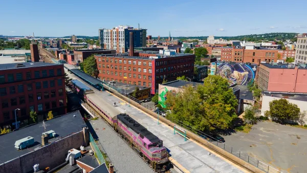
Judge Rules in Favor of Massachusetts TOD Law
The court rejected an argument that the MBTA Communities law, which requires zoning for multifamily housing, is an “unfunded mandate.”

DARTSpace Platform Streamlines Dallas TOD Application Process
The Dallas transit agency hopes a shorter permitting timeline will boost transit-oriented development around rail stations.

Planetizen Federal Action Tracker
A weekly monitor of how Trump’s orders and actions are impacting planners and planning in America.

Congressman Proposes Bill to Rename DC Metro “Trump Train”
The Make Autorail Great Again Act would withhold federal funding to the system until the Washington Metropolitan Area Transit Authority (WMATA), rebrands as the Washington Metropolitan Authority for Greater Access (WMAGA).

The Simple Legislative Tool Transforming Vacant Downtowns
In California, Michigan and Georgia, an easy win is bringing dollars — and delight — back to city centers.

The States Losing Rural Delivery Rooms at an Alarming Pace
In some states, as few as 9% of rural hospitals still deliver babies. As a result, rising pre-term births, no adequate pre-term care and harrowing close calls are a growing reality.

The Small South Asian Republic Going all in on EVs
Thanks to one simple policy change less than five years ago, 65% of new cars in this Himalayan country are now electric.

DC Backpedals on Bike Lane Protection, Swaps Barriers for Paint
Citing aesthetic concerns, the city is removing the concrete barriers and flexposts that once separated Arizona Avenue cyclists from motor vehicles.
Urban Design for Planners 1: Software Tools
This six-course series explores essential urban design concepts using open source software and equips planners with the tools they need to participate fully in the urban design process.
Planning for Universal Design
Learn the tools for implementing Universal Design in planning regulations.
Smith Gee Studio
City of Charlotte
City of Camden Redevelopment Agency
City of Astoria
Transportation Research & Education Center (TREC) at Portland State University
US High Speed Rail Association
City of Camden Redevelopment Agency
Municipality of Princeton (NJ)