


David Moser pens a compelling essay that examines the ways in which sprawling auto-dependent land use patterns exacerbate poverty. As more low-income individuals and families are pushed to the suburbs, "this problem is gaining urgency."
"There are many reasons suburbs make the experience of poverty worse, but first among them is that automobiles are really expensive," argues Moser. "Purchasing, maintaining, repairing, insuring, and fueling a car can easily consume 50% or more of a limited income. For someone struggling to work themselves out of poverty, these expenses can wreck havoc on even the most diligent efforts to maintain a monthly budget."
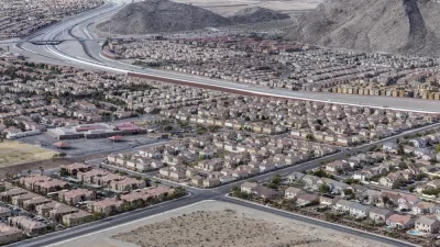
"The lower one’s income, the greater is the proportional advantage of living in a walkable, 'car-optional' neighborhood. Those with limited financial resources can benefit from walkability the most. But due to the scarcity and cost of urban housing, low-income people are being driven away from walkable urbanism and into auto-dependent sub-urbanism."
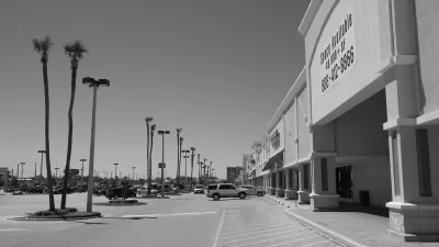
Moser uses Seattle as a case study to demonstrate that the types of environments most able to support auto-free lifestyles also have the highest rents, whereas those neighborhoods with more affordable prices also have the lowest walkability scores.
The solution? Moser says "[t]he only way to slow this process is to build enough housing to meet the demand, preferably near transit." Efforts to limit development and preserve existing "neighborhood character" must be defeated, he asserts.
FULL STORY: Driven into Poverty: Walkable urbanism and the suburbanization of poverty

Research: Sprawl Linked to Poverty
Low-income families living in high-sprawl neighborhoods are limited in their access to education, jobs, and other amenities, often trapping them in a cycle of poverty.
The Natalist Case For Sprawl (And Why It Fails)
Some commentators defend anti-urban government policies such as exclusionary zoning on the basis that homeowning suburbanites have high birth rates. But this doesn't seem to be true in recent decades.
Density and Disorder: The Imaginary Link
A recent article tries to tie public transit and walkability to social disorder — but in fact, sprawling Sunbelt cities like Memphis are as likely to have high crime rates as transit-rich metropolises such as New York and San Francisco.

Planetizen Federal Action Tracker
A weekly monitor of how Trump’s orders and actions are impacting planners and planning in America.

Maui's Vacation Rental Debate Turns Ugly
Verbal attacks, misinformation campaigns and fistfights plague a high-stakes debate to convert thousands of vacation rentals into long-term housing.

San Francisco Suspends Traffic Calming Amidst Record Deaths
Citing “a challenging fiscal landscape,” the city will cease the program on the heels of 42 traffic deaths, including 24 pedestrians.

Amtrak Rolls Out New Orleans to Alabama “Mardi Gras” Train
The new service will operate morning and evening departures between Mobile and New Orleans.

The Subversive Car-Free Guide to Trump's Great American Road Trip
Car-free ways to access Chicagoland’s best tourist attractions.

San Antonio and Austin are Fusing Into one Massive Megaregion
The region spanning the two central Texas cities is growing fast, posing challenges for local infrastructure and water supplies.
Urban Design for Planners 1: Software Tools
This six-course series explores essential urban design concepts using open source software and equips planners with the tools they need to participate fully in the urban design process.
Planning for Universal Design
Learn the tools for implementing Universal Design in planning regulations.
Heyer Gruel & Associates PA
JM Goldson LLC
Custer County Colorado
City of Camden Redevelopment Agency
City of Astoria
Transportation Research & Education Center (TREC) at Portland State University
Jefferson Parish Government
Camden Redevelopment Agency
City of Claremont