Vancouver's ahead-of-the-curve 1997 decision to prioritize active transport, rather than balance its ways of getting around, has affected everything about how the city has been designed since then.
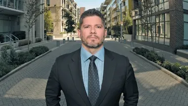


At a book launch party I had the pleasure of attending this past weekend, our host, Simon Fraser University City Program Director Gordon Price, began the evening by asking each member of the crowd to state an urban design decision that “they loved.” It was a fun and provocative question for a group of city-making wonks like us, and an even better icebreaker than the wine.
As you might imagine, each respondent had their own approach to answering the question, which is what made hearing all the excellent responses interesting.
When it came to my turn, my answer took a big picture and perhaps surprising approach, depending on your definition of urban design. In Vancouver, a city often referred to as "a city by design", the most important urban design decision we ever made, the decision I loved most, is actually usually referred to as a transportation decision.
In 1997, the city approved its first influential Transportation Plan.
It was a game-changer for our city-making model in many ways, most notably in its decision to prioritize the ways we get around, rather than balance them. The active, healthy and green ways of getting around were ranked highest - first walking, our top priority, then biking, and then transit, in that order. The prioritization then went on to goods movement for the purposes of business support and economic development, and lastly, the private vehicle.
Vancouver still spends a considerable amount of energy trying to make driving a greener and healthier proposition, with examples from electric vehicle charging station pilot projects, to policies and zoning incentives that have contributed to our incredible growth of car-sharing. However the private vehicle remains the last priority. I always note that we are not anti-car, and we rarely ban the car, but prioritizing it last has a dramatic effect on the way we design our city.
If you’re a driver who is worried about a “war on the car”, remember this - our model of city building understands the “Law of Congestion” and proves that when you build a multimodal city, it makes getting around better and easier for every mode of transportation, including the car. It makes our city work better in every way.
This decision to prioritize rather than balance our ways of getting around has affected everything in how our city has been designed since then. It’s a huge part of the essential DNA that our city has grown from. It’s guided every decision, from thousands of physical design decisions, to our budget allocation. Has every decision followed it perfectly? No - there are many illustrations around the city where the prioritization hasn't been perfectly reflected. However, enough decisions have reflected this prioritization to make our city design fundamentally different.
So my answer to Gordon’s question “what urban design decision do I love?” It’s our ahead-of-the-curve 1997 decision to prioritize active transport rather than trying to balance ways of getting around. A decision we reinforced and are taking further in the recent Transportation Plan Update I had the pleasure of working on.
A transportation decision, sure – but also an urban design decision, a city-making decision. The most important urban design decision our "city by design" ever made, flowing from the most important decision of any type we ever made – saying no to freeways in our city.
As today’s municipal leaders approach some key decisions for our city-building future, such as the opportunity to finally remove the Georgia and Dunsmuir Viaducts (which I call the only Asterisk next to the statement that we have no freeways in Vancouver) and leave a stronger and better connected city in their place, it's critically important that we remember and recognize the power of this urban design decision.
Transit leaders progress high-speed rail from Portland to Vancouver, B.C.
Washington state officials may reveal feasible routes for the high-speed rail in late 2027.
Budget constraints threaten light rail for Oregon, Washington’s new bridge
The current proposal includes only the infrastructure for the light rail, without funding for the train and tracks.
Pennsylvania 12-year transportation plan commits $13B for transit
The state's new mid-range transportation strategy includes nearly $17 billion for roads and bridges and $367 million for multimodal projects.

Planetizen Federal Action Tracker
A weekly monitor of how Trump’s orders and actions are impacting planners and planning in America.

California plans to bury El Niño’s downpour
If the state plays its cards right, it may be able to store a billion acre-feet of El Niño’s water in aquifers.

Desperate measures: Advocates weigh draining Lake Powell to fill Colorado River
Draining the reservoir could reduce evaporation losses by a couple hundred thousand acre-feet.

In Texas, data centers are swallowing promised parkland
Residents who moved to Taylor, Texas for a rural community now have to contend with three data centers in their backyard.

How a Chicago-sized wind farm beat the odds and powered on
The project spanned five presidential administrations and a standoff with a U.S. military base.

MTA gives itself 30 days to transform pit into basketball court
The site has been under construction since 2022; the city originally estimated it would finish the court in 2024.

FREE Course: Walkable City 1: Why Walkability?
After describing his path towards focusing on walkability as the essence of good planning, Jeff Speck marches through his five principal reasons for making more walkable places.
Reinventing Malls: Planning Alchemy—Turning Gray Fields Into Gold
The course focuses on the opportunities and imperatives that shape reinvention of mall sites.

City of Rosemead
Rutgers University, Edward J. Bloustein School of Planning and Public Policy
One Hundred Miles
Hunter College, City University of New York (CUNY)
The Architects Foundation
University of Cincinnati Online
City of Cambridge
Montrose County
The Pocatello Development Authority

