


One road, two counties, 19 cites - that's what and who is involved in a far-reaching plan to redesign El Camino Real, the first paved road in California, from Daly City in northern San Mateo County to San Jose in the heart of Santa Clara County.
"The Royal Road" is the English translation of El Camino Real, a road that stretches over 50 miles from the San Francisco border to San Jose, though it is called Mission Street in Daly City and The Alameda in San Jose.
Will Reisman, The (San Francisco) Examiner's transportation reporter, examines the six-year effort of the Grand Boulevard Initiative, particularly the different approach taken by transportation planners and the task force of the two counties involved.
"Planners have long hoped to adorn El Camino Real with bike lanes, pedestrian amenities, and residential and commercial development projects well-served by transit. Yet a consensus has been elusive regarding how to transform a boulevard that passes through 19 cities and two counties, leading to the glacial pace of the rehabilitation project.
In San Mateo County, cities are encouraged to adopt smaller, localized projects that fit within the vision of the Grand Boulevard Initiative. There is no countywide framework for these efforts, although transit-oriented developments have sprouted up in Redwood City and South San Francisco.
The situation is markedly different in Santa Clara County, where the Valley Transportation Authority has proposed a series of robust improvement projects for El Camino Real. The authority has recommended installing two dedicated lanes for bus rapid-transit vehicles in the center of El Camino Real, adding trees and bike paths, improving sidewalk lighting and shortening the length of crosswalks."
“The San Mateo version is very community-oriented, but it could take 60 years to accomplish,” said Kevin Connolly, an authority transportation planning manager. “We could get ours done in four years.”
While progress at transforming the state-owned road may be slow, the governing body, the Grand Boulevard Task Force and its staff, has been successful at getting funding.
According to the website, "(a)s of March 2012, the Grand Boulevard Initiative has secured $8.6 million in grant funding from programs and agencies such as the U.S. Department of Transportation TIGER II Grant Program, the California Department of Transportation, the Metropolitan Transportation Commission Climate Initiative Program, and the Silicon Valley Community Foundation. Local funding also is provided by the San Mateo County Transit District, which covers administrative expenses, and from the City/County Association of Governments of San Mateo County and the Santa Clara Valley Transportation Authority, which provide the local matching fund requirements for the current grant work."
FULL STORY: Proposal to overhaul El Camino Real paints a grand picture, but progress is lacking

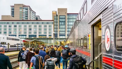
A New Ballot Measure Could Increase Caltrain's Funding by $108 Million Per Year
Santa Clara, San Mateo, and San Francisco county voters could see a ballot measure to fund an ambitious Caltrain plan with a one-eighth cent sales tax, amounting to more than $100 million dollars per year.
Three Bay Area Counties May Decide Whether to Support Caltrain with Sales Tax Measure
The oldest commuter rail line west of the Mississippi is also unique in another way—it lacks a dedicated source of operating revenue. Legislation has been introduced to allow Peninsula counties to vote to increase sales taxes by 0.125 percent.
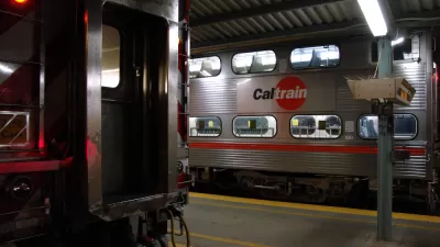
The County Transportation Authority That Saved the Caltrain Electrification Project
Up against an unexpected federal requirement to produce substantially more funds for a crucial rail project, San Mateo County's transportation authority showed the importance of "self-help" counties that control local transportation sales tax funds.

Planetizen Federal Action Tracker
A weekly monitor of how Trump’s orders and actions are impacting planners and planning in America.

Restaurant Patios Were a Pandemic Win — Why Were They so Hard to Keep?
Social distancing requirements and changes in travel patterns prompted cities to pilot new uses for street and sidewalk space. Then it got complicated.

Map: Where Senate Republicans Want to Sell Your Public Lands
For public land advocates, the Senate Republicans’ proposal to sell millions of acres of public land in the West is “the biggest fight of their careers.”

Maui's Vacation Rental Debate Turns Ugly
Verbal attacks, misinformation campaigns and fistfights plague a high-stakes debate to convert thousands of vacation rentals into long-term housing.

San Francisco Suspends Traffic Calming Amidst Record Deaths
Citing “a challenging fiscal landscape,” the city will cease the program on the heels of 42 traffic deaths, including 24 pedestrians.

California Homeless Arrests, Citations Spike After Ruling
An investigation reveals that anti-homeless actions increased up to 500% after Grants Pass v. Johnson — even in cities claiming no policy change.
Urban Design for Planners 1: Software Tools
This six-course series explores essential urban design concepts using open source software and equips planners with the tools they need to participate fully in the urban design process.
Planning for Universal Design
Learn the tools for implementing Universal Design in planning regulations.
Heyer Gruel & Associates PA
JM Goldson LLC
Custer County Colorado
City of Camden Redevelopment Agency
City of Astoria
Transportation Research & Education Center (TREC) at Portland State University
Camden Redevelopment Agency
City of Claremont
Municipality of Princeton (NJ)