AP covers the opening of the first toll lanes in LA county: 110 Freeway Express Lanes that allow solo-drivers to use a carpool lane for a toll that varies with the level of congestion (i.e. congestion pricing). Shoup asks: "Why did it take so long?"


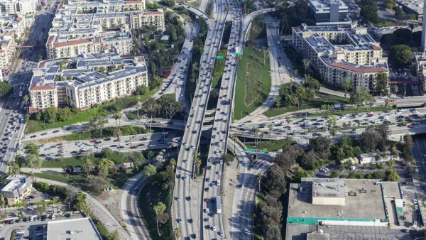
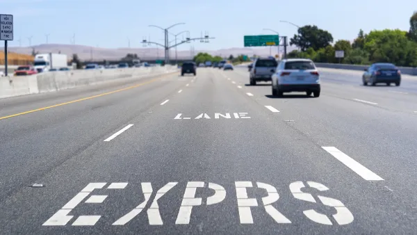
The 11 miles of converted High Occupancy Vehicle (HOV or carpool) lanes of the 110 Freeway from the 91 Freeway to downtown LA (see map) is a one-year pilot program. The lanes also go by the term, High Occupancy Toll (HOT) but will convert to HOV if speeds drop below 45 mph, according to this CBS news video report recorded opening night, Nov. 10.
"Toll roads and lanes have existed for years in neighboring Orange County and are standard on the East Coast but a novelty in Los Angeles County, and one that advocates say is long overdue and should reduce congestion for drivers in other lanes, too."
"It's about time," said Donald Shoup, a UCLA urban planning professor who has long lobbied for toll lanes and other methods of using markets to reduce congestion. "They work in San Diego; they work in many other cities. We have the worst congestion . and it's odd that we're one of the last cities to try it out."
According to KABC-TV/DT Los Angeles, prices range from "25 cents to $1.40 per mile depending on the time of day and amount of traffic. Metro estimates that it will cost a solo driver $7 per day to use the new lanes - that's $35 for a five-day workweek or $145 a month."
All vehicles using the express lanes, including carpoolers and motorcycle riders who will not be charged, "must set up an ExpressLanes FasTrak account and get a FasTrak Transponder", according to KABC-TV.
Next up for HOT conversion is a "14-mile toll lane along Interstate 10 planned for next year, and similar lanes could end up spanning the region, with scores of existing carpool lanes converted for tolls from individual drivers."
Read the full story: LA charges into new territory with express lanes
Transit Agency Chief to Propose Congestion Pricing for Los Angeles
Los Angeles Metro CEO Phil Washington will recommend to his board next Thursday that they pursue a congestion pricing program to reduce traffic congestion, improve transit, and subsidize transit fares in Los Angeles in time for the 2028 Olympics.
Congestion Pricing in the San Francisco Bay Area
Planners call them “express lanes,” but make no mistake, they are congestion pricing in action, and they're successful. The Bay Area network of what the Federal Highway Administration calls “high-occupancy toll (HOT) lanes” is growing.

LA Freeway Ramp ‘Quietly Canceled’
A 2018 lawsuit forced Metro and Caltrans to do full environmental reviews of the project, leading to its cancellation.

Planetizen Federal Action Tracker
A weekly monitor of how Trump’s orders and actions are impacting planners and planning in America.

Eastern Nebraska is running out of electricity
Data centers and electrification are straining eastern Nebraska’s grid, throttling economic development.

Study reveals best places in the U.S. for cycling, walking
New research from Streetlight Data examines bicycle and pedestrian miles per capita in the 100 largest U.S. cities by population.

DSA members accuse Mamdani of 'abandoning values' over housing redevelopment
New York City's mayor plans to replace about 2,000 units of public housing with private, mixed-income housing.

All sides of BRT debate unhappy with CDOT’s most recent move
The Colorado Department of Transportation is no longer considering center-running bus lanes for Colorado Boulevard.

Massachusetts bogs generate both power, and cranberries
Putting solar panels above farmland is one way Massachusetts is advancing toward its goal of net-zero carbon emissions by 2050.

FREE Course: Walkable City 1: Why Walkability?
After describing his path towards focusing on walkability as the essence of good planning, Jeff Speck marches through his five principal reasons for making more walkable places.
Reinventing Malls: Planning Alchemy—Turning Gray Fields Into Gold
The course focuses on the opportunities and imperatives that shape reinvention of mall sites.

City of Rosemead
Rutgers University, Edward J. Bloustein School of Planning and Public Policy
One Hundred Miles
University of Michigan School for Environment and Sustainability (SEAS)
Hunter College, City University of New York (CUNY)
The Architects Foundation
City of Cambridge
The Pocatello Development Authority
The Urban Renewal Agency of the City of Pocatello