


Mark Wilson profiles Google Maps' new feature - Photo Tours - which combs the Internet to provide 3-D tours of popular locations around the world.
Stitching together publicly available geotagged photos from sites such as Panoramio and Picasa, Google's advanced algorithm and state-of-the-art computer vision techniques produces pre-rendered 3-D animations of locations around the world, from the Coliseum to the Statue of Liberty. "The result is the view of a place from the hive mind, a collective map created from our inner auteurs."
While the feature is fairly new, its potential has Wilson buoyant with anticipation:
"As of now, the feature is clearly in its infancy. The tours are pre-rendered animations that can't be explored at-will like Street View, and just a few spots are available, as Google is manually tweaking its new crowdsourcing algorithms as it goes. But let's fast forward just a few years. As all of our pictures become geotagged by our smartphones, and as we only share more and more to the cloud, Google could combine the perspectives of, not just everyone at a single tourist destination, but everyone everywhere on the planet. They could assemble trillions of images from billions of people to create an interactive map of, not just our streets, but every inch of the entire globe."
FULL STORY: Google’s Photo Tours Suggest A Crowdsourced, 3-D World Map


Google Maps Introduces New Transit, EV Features
It will now be easier to find electric car charging stations and transit options.
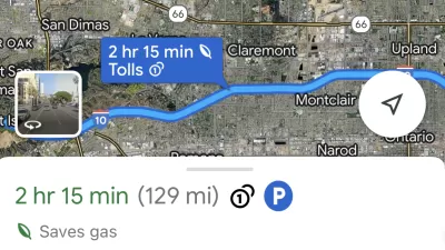
Google Maps Feature Identifies Most Fuel-Efficient Routes
A new feature highlights routes that use the least gas to help users make the most fuel-efficient driving decisions.

Google Maps Now Lets You Feed Your Parking Meter
Google's newest partnership offers contactless parking meter payments and transit fare purchases.

Planetizen Federal Action Tracker
A weekly monitor of how Trump’s orders and actions are impacting planners and planning in America.

Restaurant Patios Were a Pandemic Win — Why Were They so Hard to Keep?
Social distancing requirements and changes in travel patterns prompted cities to pilot new uses for street and sidewalk space. Then it got complicated.

Map: Where Senate Republicans Want to Sell Your Public Lands
For public land advocates, the Senate Republicans’ proposal to sell millions of acres of public land in the West is “the biggest fight of their careers.”

Maui's Vacation Rental Debate Turns Ugly
Verbal attacks, misinformation campaigns and fistfights plague a high-stakes debate to convert thousands of vacation rentals into long-term housing.

San Francisco Suspends Traffic Calming Amidst Record Deaths
Citing “a challenging fiscal landscape,” the city will cease the program on the heels of 42 traffic deaths, including 24 pedestrians.

California Homeless Arrests, Citations Spike After Ruling
An investigation reveals that anti-homeless actions increased up to 500% after Grants Pass v. Johnson — even in cities claiming no policy change.
Urban Design for Planners 1: Software Tools
This six-course series explores essential urban design concepts using open source software and equips planners with the tools they need to participate fully in the urban design process.
Planning for Universal Design
Learn the tools for implementing Universal Design in planning regulations.
Heyer Gruel & Associates PA
JM Goldson LLC
Custer County Colorado
City of Camden Redevelopment Agency
City of Astoria
Transportation Research & Education Center (TREC) at Portland State University
Camden Redevelopment Agency
City of Claremont
Municipality of Princeton (NJ)