


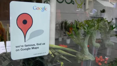
Google Maps

Google Maps Introduces New Transit, EV Features
It will now be easier to find electric car charging stations and transit options.
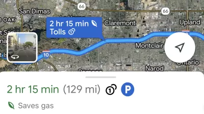
Google Maps Feature Identifies Most Fuel-Efficient Routes
A new feature highlights routes that use the least gas to help users make the most fuel-efficient driving decisions.

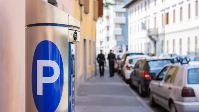
Google Maps Now Lets You Feed Your Parking Meter
Google's newest partnership offers contactless parking meter payments and transit fare purchases.
Meet Google's Open Source, Time-Traveling Map
All historic maps are welcome in Google's open source machine learning project.

New Google Map Layer Shows COVID-19 Infection Rates
A new layer showing the seven-day average of confirmed COVID-19 cases started rolling out to Android and iPhones last week.
New Opportunities for Big Data in Pandemic-Era Urban Planning
Big data startups and corporations are collecting information that can help planners make informed decisions about how to facilitate social distancing. Will planners center data-driven decisions in other planning processes?

Real-Time Art Installation Reveals the Many Dimensions of Data
Using a wagon filled with phones, an artist in Berlin demonstrated the disconnect between data and the real world.
Google Maps for iPhone Now Reports DUI Checkpoints, Speed Traps
Navigation app Waze has long allowed users the ability to report various "inconveniences" on the road, like speed traps, checkpoints, and crashes. Now Google Maps users on iPhone can do the same.
Walking Directions, Assisted by Augmented Reality
Augmented reality could boost safety for pedestrians, or it could add another layer of distraction between people and the real world.

Google Maps' Digital Erasure Highlights Issues of Community Identity in Buffalo, NY
In the face of displacement and gentrification, residents of the Fruit Belt neighborhood of Buffalo, NY point to tech-giant Google's map service as one among many possible causes.

Google Maps Goes Multi-Modal
A bunch of new features makes Google Maps user-friendly for transit commuters.
The Gig Economy for Mapping
A new startup wants to use blockchain and the Uber model to create free, open-source maps.

New Tool Calculates the Carbon Footprint of Cities
Google's Environmental Insights Explorer multiplies the power of Google Maps for the benefit of the planet.
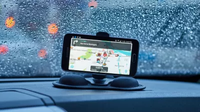
Drivers: Beware Following GPS Navigation Instructions Too Closely
For the second time at the same railroad crossing in Atherton, California, a motorist followed his GPS navigation onto Caltrain tracks. In both cases, the motorists fled their vehicles before being hit by an oncoming train.
Flooded With Navigation App Users, a Town Closes Its Streets
Navigation apps like Waze often reroute drivers onto residential streets that would be quiet otherwise. With some residents unable to leave their driveways, the New Jersey borough of Leonia has taken an extreme measure against the problem.

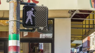
Google Expands Wheelchair Access Mapping
Offering prizes and status, Google wants to motivate Maps users to add information about wheelchair accessibility.
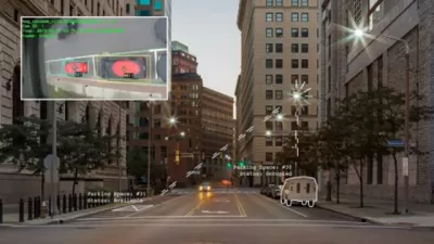
Google Can Now Predict Parking Difficulty
The way Google predicts parking difficulty could make it easier to develop "smart city" applications in the future.
Google Maps Update Opens New Access to Mobility and Culture
Google Maps and other navigation and mapping apps have done a lot to inspire and educate people to make the most of their surroundings. New changes to the Google Maps app will add new functionality for those purposes.
Google Maps' 'Interesting' New Feature
Google's new maps redesign calls out areas of interest, but is "interesting" just a euphemism for rich?
Google Maps Erases Publically Owned Open Spaces
Where's the green?
City of Costa Mesa
Licking County
Barrett Planning Group LLC
HUD's Office of Policy Development and Research
Mpact Transit + Community
HUD's Office of Policy Development and Research
Tufts University, Department of Urban and Environmental Policy & Planning
City of Universal City TX
ULI Northwest Arkansas
Urban Design for Planners 1: Software Tools
This six-course series explores essential urban design concepts using open source software and equips planners with the tools they need to participate fully in the urban design process.
Planning for Universal Design
Learn the tools for implementing Universal Design in planning regulations.


