


Kaid Benfield looks at shortcomings of the dominant national apparatus for regional planning - the Metropolitan Planning Organization - through the lens of transportation, and pines for new mechanisms for regional cooperation.
The opportunities and challenges of contemporary planning and development, from transportation to economic development to climate change, do not stop at municipal borders. However, planning often does. As such, according to Benfield, "Our highly fragmented "system" of local governments makes it nearly impossible to address important issues facing metropolitan America in a rational way."
Using case studies of failed transportation integration in Philadelphia and Washington D.C., Benfield points to the shortcoming of MPOs in integrating cross-jurisdictional planning: "Especially when it comes to land use, MPOs are basically advisory, and their ability to influence what jurisdictions within their purview choose to do with regard to transportation, economic development, and other matters of great import tends to be extremely limited."
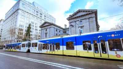
So what models for more effective regional cooperation are out there? Benfield looks to Portland's precedent-setting Metro, "the nation's only directly elected regional government with legal authority over regional land use, transportation, and other specified issues in three counties and 25 cities...But Metro's jurisdiction does not extend to those parts of the Portland region across the Columbia River in Washington, which lag behind their Oregon neighbors in addressing these issues."
He also looks to the SB 375, California's "innovative planning law to reduce pollution of greenhouse gases" as "the new frontier for regionalism in the US." The jury is out, however, on the extent to which the economic and regulatory incentives included in the law will be enough to empower the state's MPOs to exercise influence over regional land use and transportation patterns to a larger extent than prior models.
FULL STORY: Sustainability in the crazy-quilt world of metro regions


How Much for Roads and Highways in a Proposed Portland-Area Transportation Funding Measure?
A regional transportation tax could be on the 2020 ballot in Portland and surrounding communities in Oregon. How much of that money created by the new tax, should it pass, will go to transit and how much will go to cars is an open question.
Big Business in Portland Doesn't Want to Pay for Metro Transportation Funding Measure
A heated dispute over a $5 billion Metro transportation funding ballot measure has erupted between climate activists and a group representing Portland's big business interests.
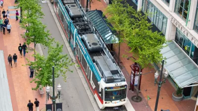
Making it Safer to Walk to Transit in Portland
TriMet, the regional transit agency in the Portland, Oregon area, this week launched a process for creating a new Pedestrian Plan.

Planetizen Federal Action Tracker
A weekly monitor of how Trump’s orders and actions are impacting planners and planning in America.

Maui's Vacation Rental Debate Turns Ugly
Verbal attacks, misinformation campaigns and fistfights plague a high-stakes debate to convert thousands of vacation rentals into long-term housing.

San Francisco Suspends Traffic Calming Amidst Record Deaths
Citing “a challenging fiscal landscape,” the city will cease the program on the heels of 42 traffic deaths, including 24 pedestrians.

Amtrak Rolls Out New Orleans to Alabama “Mardi Gras” Train
The new service will operate morning and evening departures between Mobile and New Orleans.

The Subversive Car-Free Guide to Trump's Great American Road Trip
Car-free ways to access Chicagoland’s best tourist attractions.

San Antonio and Austin are Fusing Into one Massive Megaregion
The region spanning the two central Texas cities is growing fast, posing challenges for local infrastructure and water supplies.
Urban Design for Planners 1: Software Tools
This six-course series explores essential urban design concepts using open source software and equips planners with the tools they need to participate fully in the urban design process.
Planning for Universal Design
Learn the tools for implementing Universal Design in planning regulations.
Heyer Gruel & Associates PA
JM Goldson LLC
Custer County Colorado
City of Camden Redevelopment Agency
City of Astoria
Transportation Research & Education Center (TREC) at Portland State University
Jefferson Parish Government
Camden Redevelopment Agency
City of Claremont