


Real estate's favorite tool for gauging neighborhood walkability now has a companion for transit, Kaid Benfield reports.
As we mentioned earlier this month, the company Walk Score has made a name for itself by creating a system that anyone can use to determine how walkable a neighborhood is. Now, they're expanding that service to measure the usability of transit, too.
According to the index, the nation's top ten cities for transit are (in ascending order):
- Portland, OR (Transit Score: 50)
- Baltimore, MD (57)
- Miami, FL (57)
- Seattle, WA (59)
- Chicago, IL (65)
- Philadelphia, PA (68)
- Washington, D.C. (69)
- Boston, MA (74)
- San Francisco, CA (80)
- New York, NY (81)
Perhaps not surprisingly, the best eight cities for transit top Walk Score's walkability index, too (in a slightly different order).
Benfield explains how the numbers were crunched: "In calculating a Transit Score for a particular location, a 'usefulness' value is assigned to nearby transit routes based on frequency of service, type of route, and distance to the nearest stop on the route. City scores are then calculated by applying the Transit Score algorithm block-by-block throughout the city and weighting the scores by population density. Walk Score's web site contains a detailed description of the methodology used in the transit ratings."
FULL STORY: America's best cities for public transportation
The High-Tech Urban Experience, Now Standardized
The seven largest metros in the nation are teaming up to unify the technologies that are revolutionizing life in the city, Steve Towns reports.
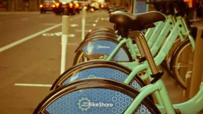
Bike Share Lessons From the Pandemic
Bike share data from six U.S. cities offer insight into how Americans have changed travel patterns during the pandemic.
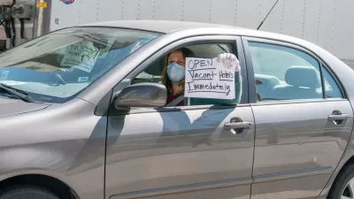
Hotels Could Play a Critical Role in Containing Coronavirus in Crowded Cities
Some cities are leasing entire hotels to provide rooms for people who have tested positive for COVID-19 or been exposed to infected people, to allow for safe and supportive isolation away from family or household members who risk being infected.

Coming Soon to Ohio: The Largest Agrivoltaic Farm in the US
The ambitious 6,000-acre project will combine an 800-watt solar farm with crop and livestock production.

Pennsylvania Mall Conversion Bill Passes House
If passed, the bill would promote the adaptive reuse of defunct commercial buildings.

U.S. Supreme Court: California's Impact Fees May Violate Takings Clause
A California property owner took El Dorado County to state court after paying a traffic impact fee he felt was exorbitant. He lost in trial court, appellate court, and the California Supreme Court denied review. Then the U.S. Supreme Court acted.

Colorado Bill Would Tie Transportation Funding to TOD
The proposed law would require cities to meet certain housing targets near transit or risk losing access to a key state highway fund.

Dallas Surburb Bans New Airbnbs
Plano’s city council banned all new permits for short-term rentals as concerns about their impacts on housing costs grow.

Divvy Introduces E-Bike Charging Docks
New, circular docks let e-bikes charge at stations, eliminating the need for frequent battery swaps.
City of Costa Mesa
Licking County
Barrett Planning Group LLC
HUD's Office of Policy Development and Research
Mpact Transit + Community
HUD's Office of Policy Development and Research
Tufts University, Department of Urban and Environmental Policy & Planning
City of Universal City TX
ULI Northwest Arkansas
Urban Design for Planners 1: Software Tools
This six-course series explores essential urban design concepts using open source software and equips planners with the tools they need to participate fully in the urban design process.
Planning for Universal Design
Learn the tools for implementing Universal Design in planning regulations.