A year after its release, Tom Stoelker tracks the progress of New York's comprehensive plan for its waterfront, Vision 2020, the recent recipient of the APA's Daniel Burnham Award.


As the changes proposed in Vision 2020, the city's comprehensive 10-year vision for the future of its 520 miles of shoreline, continue to work their way through legal channels to become law, Stoelker looks at the concepts seeking to change the way the city relates to its "Sixth Borough".
Stoelker highlights the ways in which the document embraces some of the innovative ideas that have been advanced in the ten years since the last revision to the city's Waterfront Revitalization Program (WRP), as "waterfront planning has become a prominent topic for museum exhibitions, a host of idea competitions, and university architecture studios."
One example is Oyster-tecture, a concept developed by SCAPE Landscape Architecture for MoMA's 2010 Rising Currents exhibition, which "showed how farming oysters in New York Harbor could help naturally mitigate pollution. Likewise, a text amendment encourages users to 'seek opportunities to create a mosaic of habitats with high ecological value.' The text calls out the oysters in particular, though mussels, eelgrass, fish, and crabs get their due," notes Stoelker.
Read the full story: Clearing Vision

Manhattan Waterfront Parking Lot to Become Public Park
A lot that has served as parking for decades will add a much-needed public amenity to the East River waterfront.
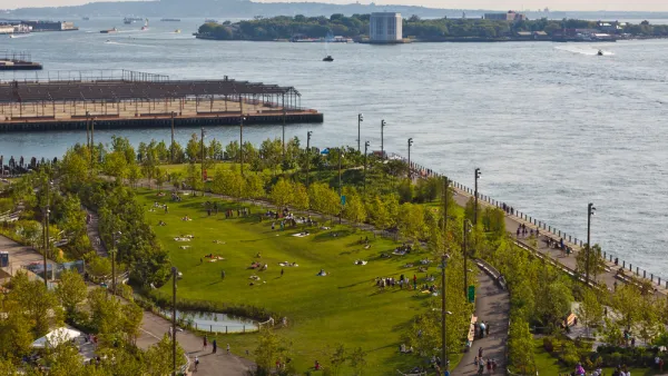
New York Updating its Comprehensive Waterfront Plan
Vision 2030 will update the award winning Vision 2020 New York City Comprehensive Waterfront Plan.
Along New York's Waterfront, An Opportunity Without Peer
New York's lengthy waterfront was once dotted with an extensive array of piers, reaching like tentacles from the city's shores into the surrounding harbor and rivers. As the city again embraces its waterfront, those that remain are getting new life.

Planetizen Federal Action Tracker
A weekly monitor of how Trump’s orders and actions are impacting planners and planning in America.

Eastern Nebraska is running out of electricity
Data centers and electrification are straining eastern Nebraska’s grid, throttling economic development.

Study reveals best places in the U.S. for cycling, walking
New research from Streetlight Data examines bicycle and pedestrian miles per capita in the 100 largest U.S. cities by population.

DSA members accuse Mamdani of 'abandoning values' over housing redevelopment
New York City's mayor plans to replace about 2,000 units of public housing with private, mixed-income housing.

All sides of BRT debate unhappy with CDOT’s most recent move
The Colorado Department of Transportation is no longer considering center-running bus lanes for Colorado Boulevard.

Massachusetts bogs generate both power, and cranberries
Putting solar panels above farmland is one way Massachusetts is advancing toward its goal of net-zero carbon emissions by 2050.

FREE Course: Walkable City 1: Why Walkability?
After describing his path towards focusing on walkability as the essence of good planning, Jeff Speck marches through his five principal reasons for making more walkable places.
Reinventing Malls: Planning Alchemy—Turning Gray Fields Into Gold
The course focuses on the opportunities and imperatives that shape reinvention of mall sites.

City of Rosemead
Rutgers University, Edward J. Bloustein School of Planning and Public Policy
One Hundred Miles
University of Michigan School for Environment and Sustainability (SEAS)
Hunter College, City University of New York (CUNY)
The Architects Foundation
City of Cambridge
The Pocatello Development Authority
The Urban Renewal Agency of the City of Pocatello