


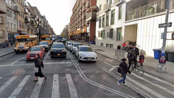
The Transport Politic details the City of New York's plans for a citywide busway on 34th Street.
Despite little money in its transportation coffers, the city analyzed a variety of transit options for the 34th Street corridor. This piece looks at why the busway was selected.
"It's sometimes worth considering the hoops through which transit agencies must jump in order to bring their visions to fruition.
But the alternatives analysis did allow New York City's DOT to demonstrate why it considers a dedicated transitway for bus service to be the ideal technology candidate for the two-mile 34th street corridor, running river to river. The mode allows the use of existing vehicles and the through-routing of express buses from elsewhere in the city - something not possible had streetcars or light rail been chosen. It would also be relatively cheap to implement, at between $30 and 125 million, versus $250 million and up for light rail or several billion for a full-scale subway line.
The transitway would allow commuters to get across the city 35% faster than possible today, cutting transit times to 20 minutes, just slightly longer than would be feasible with a light rail line."
FULL STORY: New York Plans Transitway on 34th Street, but It's Not BRT, for Better or Worse


Is N.Y.C.’s 14th Street Busway the Future of Transportation?
The success of the busway project could point to a longer-term shift away from planning and design strategies that favor cars.
Fully-Separated Busway Planned for NYC
NY's Dept. of Transportation has released pictures of a planned separated bus route on 34th St., which would be a first for the city.
Judge Halts Brooklyn Bike Lane Removal
Lawyers must prove the city was not acting “arbitrarily, capriciously, and illegally” in ordering the hasty removal.

Planetizen Federal Action Tracker
A weekly monitor of how Trump’s orders and actions are impacting planners and planning in America.

San Francisco's School District Spent $105M To Build Affordable Housing for Teachers — And That's Just the Beginning
SFUSD joins a growing list of school districts using their land holdings to address housing affordability challenges faced by their own employees.

Can We Please Give Communities the Design They Deserve?
Often an afterthought, graphic design impacts everything from how we navigate a city to how we feel about it. One designer argues: the people deserve better.

The EV “Charging Divide” Plaguing Rural America
With “the deck stacked” against rural areas, will the great electric American road trip ever be a reality?

Judge Halts Brooklyn Bike Lane Removal
Lawyers must prove the city was not acting “arbitrarily, capriciously, and illegally” in ordering the hasty removal.

Engineers Gave America's Roads an Almost Failing Grade — Why Aren't We Fixing Them?
With over a trillion dollars spent on roads that are still falling apart, advocates propose a new “fix it first” framework.
Urban Design for Planners 1: Software Tools
This six-course series explores essential urban design concepts using open source software and equips planners with the tools they need to participate fully in the urban design process.
Planning for Universal Design
Learn the tools for implementing Universal Design in planning regulations.
Borough of Carlisle
Smith Gee Studio
City of Camden Redevelopment Agency
City of Astoria
Transportation Research & Education Center (TREC) at Portland State University
City of Camden Redevelopment Agency
Municipality of Princeton (NJ)