


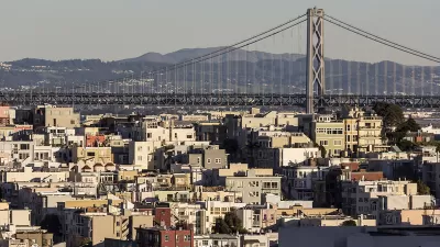
Planners in San Francisco are proposing a 145-acre "transit center district" that would dramatically reshape the city's skyline.
"The 145-acre 'Transit Center District' would redraw San Francisco's skyline with a half-dozen towers taller than almost any in the city, including one stretching at least 100 feet higher than the Transamerica Pyramid. The plan would widen the sidewalks and narrow the streets around a rebuilt terminal. It also would reroute most Bay Bridge commuter traffic outside the pedestrian-oriented district.
Officials say they're confident the 147-page plan, which has been in the works since 2007, will bear fruit despite a stumbling economy that has stalled several projects in the area."
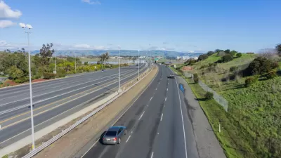
The project will surround the Transbay Terminal, which is set to see a broad renovation to make room for high speed rail.
FULL STORY: Towering plan for new S.F. skyline unveiled

Infrastructure vs. Housing
Do shortages of infrastructure justify restrictive zoning?
Bay Area Planners Acknowledge the Need for Regional Housing Solutions
While most Bay Area communities are pursuing housing solutions "individually," local planners acknowledge the need for strategies that address the regional as a unified whole.

S.F.'s Transbay Transit Center Won't Reopen Until June at the Earliest
The Transbay Transit Center, opened for a brief stint in the latter half of 2018 before structural flaws were discovered, won't be open to the public again anytime soon.

Planetizen Federal Action Tracker
A weekly monitor of how Trump’s orders and actions are impacting planners and planning in America.

Congressman Proposes Bill to Rename DC Metro “Trump Train”
The Make Autorail Great Again Act would withhold federal funding to the system until the Washington Metropolitan Area Transit Authority (WMATA), rebrands as the Washington Metropolitan Authority for Greater Access (WMAGA).

DARTSpace Platform Streamlines Dallas TOD Application Process
The Dallas transit agency hopes a shorter permitting timeline will boost transit-oriented development around rail stations.

Renters Now Outnumber Homeowners in Over 200 US Suburbs
High housing costs in city centers and the new-found flexibility offered by remote work are pushing more renters to suburban areas.

The Tiny, Adorable $7,000 Car Turning Japan Onto EVs
The single seat Mibot charges from a regular plug as quickly as an iPad, and is about half the price of an average EV.

Supreme Court Ruling in Pipeline Case Guts Federal Environmental Law
The decision limits the scope of a federal law that mandates extensive environmental impact reviews of energy, infrastructure, and transportation projects.
Urban Design for Planners 1: Software Tools
This six-course series explores essential urban design concepts using open source software and equips planners with the tools they need to participate fully in the urban design process.
Planning for Universal Design
Learn the tools for implementing Universal Design in planning regulations.
Municipality of Princeton
Roanoke Valley-Alleghany Regional Commission
City of Mt Shasta
City of Camden Redevelopment Agency
City of Astoria
Transportation Research & Education Center (TREC) at Portland State University
US High Speed Rail Association
City of Camden Redevelopment Agency
Municipality of Princeton (NJ)