


America 2050 recently released a report ranking the best intercity corridors for high speed rail investment.
The Infrastructurist takes a look at the report:
"The rankings are based on six factors: population, the size the local economy, distance between cities (with 250 miles being optimum), the quality of the local transit networks at each end, how bad the highway congestion is both cities (on the idea that this dissuades driving), and whether the cities are in a mega-region.
Naturally, tops on the list was a NY-Washington DC link–probably as good a natural candidate for HSR as any route in the world."
FULL STORY: Here's How We Should Build Out A High-Speed Rail Network


Car-Centric LA Suburb Looks to a Train-Oriented Future
City leaders in Rancho Cucamonga, the future western terminus of the Brightline West rail line to Las Vegas, want to reimagine the city as a transit-oriented, pedestrian-friendly community.
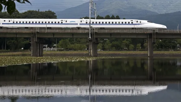
Texas, California Rail Projects Seek Out Private Funding
In the wake of Trump’s cuts to high-speed rail projects, rail authorities are looking to private-public partnerships to supplement their budgets.

California High-Speed Rail's Plan to Right Itself
The railroad's new CEO thinks he can get the project back on track. The stars will need to align this summer.

Planetizen Federal Action Tracker
A weekly monitor of how Trump’s orders and actions are impacting planners and planning in America.

Map: Where Senate Republicans Want to Sell Your Public Lands
For public land advocates, the Senate Republicans’ proposal to sell millions of acres of public land in the West is “the biggest fight of their careers.”

Restaurant Patios Were a Pandemic Win — Why Were They so Hard to Keep?
Social distancing requirements and changes in travel patterns prompted cities to pilot new uses for street and sidewalk space. Then it got complicated.

San Francisco Suspends Traffic Calming Amidst Record Deaths
Citing “a challenging fiscal landscape,” the city will cease the program on the heels of 42 traffic deaths, including 24 pedestrians.

California Homeless Arrests, Citations Spike After Ruling
An investigation reveals that anti-homeless actions increased up to 500% after Grants Pass v. Johnson — even in cities claiming no policy change.

Albuquerque Route 66 Motels Become Affordable Housing
A $4 million city fund is incentivizing developers to breathe new life into derelict midcentury motels.
Urban Design for Planners 1: Software Tools
This six-course series explores essential urban design concepts using open source software and equips planners with the tools they need to participate fully in the urban design process.
Planning for Universal Design
Learn the tools for implementing Universal Design in planning regulations.
Heyer Gruel & Associates PA
JM Goldson LLC
Custer County Colorado
City of Camden Redevelopment Agency
City of Astoria
Transportation Research & Education Center (TREC) at Portland State University
Camden Redevelopment Agency
City of Claremont
Municipality of Princeton (NJ)