


I’ve read some airport-related planning literature about the interiors of airports and about their public transit connections. (For a good example of the latter, see http://www.planetizen.com/node/34842 ) But one other difference between airports relates to their exteriors: the difference between walkable airports and not-so-walkable airports.

I've read some airport-related planning literature about the interiors of airports and about their public transit connections. (For a good example of the latter, see http://www.planetizen.com/node/34842 ) But one other difference between airports relates to their exteriors: the difference between walkable airports and not-so-walkable airports.
Many airports resemble that of Jacksonville, Florida (where I lived until a week ago). The airport is 15 miles or so from downtown Jacksonville, and is along a long stretch of vacant, undeveloped land. If you were to walk outside the airport, you would be utterly disoriented: you wouldn't know whether you were in a big city or a small town. So as a practical matter, the only sane way to exit the airport is by car or bus.
By contrast, a few nights ago I arrived at the airport in Little Rock, Arkansas. As soon as I left the airport terminal, I could actually see the towers of downtown Little Rock. More usefully still, I could see the hotel I was staying at, and (after a minute of false starts) was actually able to walk to it. The airport was hardly in an urban environment: I walked on grass instead of on a sidewalk. Even so, I felt like I was near a city, rather than in the middle of nowhere.
Better still is Providence's airport, where a decade ago I was able to walk from the airport to a thriving inner suburban neighborhood. I went on walkscore.com and was not surprised by the results: the Walkscore of Jacksonville's airport address was 15 (primarily due to on-premises shopping), the Walkscore of Little Rock's airport was 22, and the Walkscore of Providence's a stunning 65.
Of course, an airport cannot be as walkable as, say, a bus or train station: often, an airport needs to have spare land so it can expand in the future. Nevertheless, an airport that is near other visible amenities, like a train station near such amenities, is inherently a more pleasurable one.

London's Mayor Takes Stand Against Airport Expansion
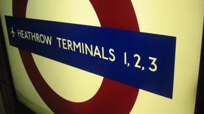
London Mayor Sadiq Khan has aligned himself with opponents to the addition of a third runway at London's Heathrow Airport, citing noise and air pollution concerns
London's Airports - The Ultimate Transit Orientated Development?
London's mayor, Boris Johnson, has long favoured the creation of a new airport in the Thames Estuary over expanding Heathrow. New claims of boosting house building in west London have generated further criticism.
Only Federal Funding Will Deliver Sydney's Second Airport
New South Wales' new planning minister has called on Australia's federal government to decide and fund much needed infrastructure.

Planetizen Federal Action Tracker
A weekly monitor of how Trump’s orders and actions are impacting planners and planning in America.

Restaurant Patios Were a Pandemic Win — Why Were They so Hard to Keep?
Social distancing requirements and changes in travel patterns prompted cities to pilot new uses for street and sidewalk space. Then it got complicated.

Map: Where Senate Republicans Want to Sell Your Public Lands
For public land advocates, the Senate Republicans’ proposal to sell millions of acres of public land in the West is “the biggest fight of their careers.”

Maui's Vacation Rental Debate Turns Ugly
Verbal attacks, misinformation campaigns and fistfights plague a high-stakes debate to convert thousands of vacation rentals into long-term housing.

San Francisco Suspends Traffic Calming Amidst Record Deaths
Citing “a challenging fiscal landscape,” the city will cease the program on the heels of 42 traffic deaths, including 24 pedestrians.

California Homeless Arrests, Citations Spike After Ruling
An investigation reveals that anti-homeless actions increased up to 500% after Grants Pass v. Johnson — even in cities claiming no policy change.
Urban Design for Planners 1: Software Tools
This six-course series explores essential urban design concepts using open source software and equips planners with the tools they need to participate fully in the urban design process.
Planning for Universal Design
Learn the tools for implementing Universal Design in planning regulations.
Heyer Gruel & Associates PA
JM Goldson LLC
Custer County Colorado
City of Camden Redevelopment Agency
City of Astoria
Transportation Research & Education Center (TREC) at Portland State University
Camden Redevelopment Agency
City of Claremont
Municipality of Princeton (NJ)