


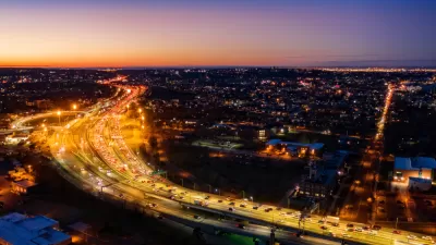
On Monday, Gothamist revealed the winners of a contest to redesign the traffic-clogged intersection of 4th Avenue and 9th Street in Brooklyn.
"Transportation Alternatives announced three winners today for 'Designing the 21st Century Street,' an open design competition that challenged New Yorkers to safely accommodate pedestrians, bicyclists, transit, trucks and cars on the same 'complete street' – something that has long eluded New York City street design. The winning entries, 'Shared Space' by Steven Nutter, 'Streets for Everyone' by Rogers Marvel Architects, and "Streets Come Alive" by LEVON, each prioritized pedestrians and bicyclists first, while maintaining the street as a transit hub and truck route.
More than 100 submissions from 13 countries tried to tackle the intersection of 4th Avenue and 9th Street in Brooklyn, a crossing that exemplifies car-first design by encouraging speeding and reckless driving while all but ignoring the walking and biking environment. Submissions ranged from the esoteric (a giant mirror placed in the center of the intersection, slowing cars with the illusion of a head-on collision) to the fine-tuned weaving of dedicated bike, car and transit lanes.
'We asked entrants to thread the needle of safety and mobility while designing world-class public space. Given that this intersection is one of the city's most problematic crossings, each of the winning designs could serve as a template for countless streets across NYC,' says Paul Steely White, Executive Director of Transportation Alternatives, the competition's sponsor."
Thanks to Wiley Norvell
FULL STORY: 21st Century Street Designers Reimagine 4th Ave & 9th

Manhattan Traffic Spreading to Other Boroughs
New travel patterns and an increased reliance on delivery services and ride-hailing are creating more congestion in New York's outer boroughs.
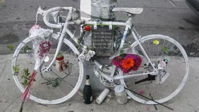
Horrific Cyclist's Death in Brooklyn Prompts Calls for New Thinking on Cars
José Alzorriz was killed while waiting on a bike at a red light. An SUV, T-boned by a red light-runner, literally flew into him.
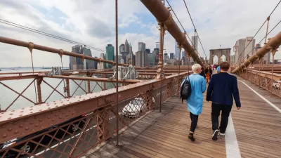
Modal Friction on the Brooklyn Bridge
The popularity of crossing New York City's second oldest bridge by foot and pedal is causing friction between the two modes on the promenade above six lanes of motor vehicle traffic. A report released for NYCDOT proposes recommendations.

Planetizen Federal Action Tracker
A weekly monitor of how Trump’s orders and actions are impacting planners and planning in America.

Map: Where Senate Republicans Want to Sell Your Public Lands
For public land advocates, the Senate Republicans’ proposal to sell millions of acres of public land in the West is “the biggest fight of their careers.”

Restaurant Patios Were a Pandemic Win — Why Were They so Hard to Keep?
Social distancing requirements and changes in travel patterns prompted cities to pilot new uses for street and sidewalk space. Then it got complicated.

Platform Pilsner: Vancouver Transit Agency Releases... a Beer?
TransLink will receive a portion of every sale of the four-pack.

Toronto Weighs Cheaper Transit, Parking Hikes for Major Events
Special event rates would take effect during large festivals, sports games and concerts to ‘discourage driving, manage congestion and free up space for transit.”

Berlin to Consider Car-Free Zone Larger Than Manhattan
The area bound by the 22-mile Ringbahn would still allow 12 uses of a private automobile per year per person, and several other exemptions.
Urban Design for Planners 1: Software Tools
This six-course series explores essential urban design concepts using open source software and equips planners with the tools they need to participate fully in the urban design process.
Planning for Universal Design
Learn the tools for implementing Universal Design in planning regulations.
Heyer Gruel & Associates PA
JM Goldson LLC
Custer County Colorado
City of Camden Redevelopment Agency
City of Astoria
Transportation Research & Education Center (TREC) at Portland State University
Camden Redevelopment Agency
City of Claremont
Municipality of Princeton (NJ)