


In a huge blow to a city already polarized by a ballot-box planning initiative affecting open space on the November ballot, a judge has halted downtown redevelopment by rejecting the Environmental Impact Report in part because of the 'shadow effect'.
"San Mateo County Superior Court Judge Marie S. Weiner threw out Redwood City's certification of the Downtown Precise Plan's environmental impact report and said the city cannot issue any building permits under the plan until it fixes the deficiencies in the report.
Weiner sided with (plantiffs) who filed the suit claiming the city failed to consider the plan's potential to create shadows from tall buildings and impact the city's historic resources.
Weiner had issued a tentative ruling April 24 drawing the same conclusions about the documents for the plan, which she called an attempt to "Manhattanize" downtown with 2,500 new units of high-density housing plus retail and office space."
---------------------------------------------------------
From Oakland Tribune via BNET:
"Add the Redwood City Council to the growing list of opponents of a November ballot measure that would require referendums on open space land-use decisions.
With a formal resolution, the council Monday night made official its contempt for Measure W, also known as Open Space Vote, which would require two-thirds of resident voters to approve development in areas the measure defines as "open space."
Council members in recent months have lamented that proponents of the initiative -- environmental groups Save the Bay and the Friends of Redwood City -- didn't write a measure specifically targeting the Cargill Salt lands, a 1,433-acre area east of Highway 101 that the groups acknowledge is their primary focus."
FULL STORY: Redwood City faces decision on downtown plan

In Defense of Uncertainty in the Development Approval Process
While streamlining and anti-NIMBYism are in vogue, Murtaza Baxamusa reminds us what's really at stake.

Office Conversions Have Increased Every Year This Decade
Since the pandemic, office vacancy rates remain high, leading many cities to adjust zoning codes to accommodate adaptive reuse.
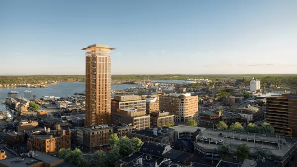
Downtown Portland Ready for Maine's Tallest Building
The city of Portland anticipates a major new urban development addition called the “Old Port Square” project.

Planetizen Federal Action Tracker
A weekly monitor of how Trump’s orders and actions are impacting planners and planning in America.

Restaurant Patios Were a Pandemic Win — Why Were They so Hard to Keep?
Social distancing requirements and changes in travel patterns prompted cities to pilot new uses for street and sidewalk space. Then it got complicated.

Map: Where Senate Republicans Want to Sell Your Public Lands
For public land advocates, the Senate Republicans’ proposal to sell millions of acres of public land in the West is “the biggest fight of their careers.”

Orange County, Florida Adopts Largest US “Sprawl Repair” Code
The ‘Orange Code’ seeks to rectify decades of sprawl-inducing, car-oriented development.

Maui's Vacation Rental Debate Turns Ugly
Verbal attacks, misinformation campaigns and fistfights plague a high-stakes debate to convert thousands of vacation rentals into long-term housing.

San Francisco Suspends Traffic Calming Amidst Record Deaths
Citing “a challenging fiscal landscape,” the city will cease the program on the heels of 42 traffic deaths, including 24 pedestrians.
Urban Design for Planners 1: Software Tools
This six-course series explores essential urban design concepts using open source software and equips planners with the tools they need to participate fully in the urban design process.
Planning for Universal Design
Learn the tools for implementing Universal Design in planning regulations.
Heyer Gruel & Associates PA
JM Goldson LLC
Custer County Colorado
City of Camden Redevelopment Agency
City of Astoria
Transportation Research & Education Center (TREC) at Portland State University
Camden Redevelopment Agency
City of Claremont
Municipality of Princeton (NJ)