


With a growing population, a sprawling urban landscape, and uncertain public funding, Los Angeles seems to be hoping for a miracle with its latest transportation planning effort.
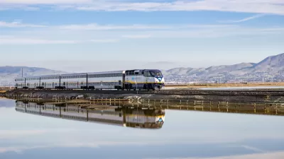
"Los Angeles' population will grow by 2.4 million by 2030, resulting in a total of 7 million cars on the roads each day. Already, congestion in Los Angeles is one of the worst in the nation, and the city's rapid transit surely does not have enough connections or lines to serve the entire city or region. According to the U.S. Census Bureau, the percentage of commuters who use public transportation in Los Angeles County is 7% (10% within the borders of the city of Los Angeles), far lower than in other major American cities: 30% of San Franciscan workers use transit, 25% within Chicago, and 54% in New York City. With the region's growing population, the city will not be able to support itself without future investments in transportation. Mobility, as stated by Roger Snoble, the Chief Executive Officer of the Los Angeles Metropolitan Transportation Authority (MTA), is a key aspect in determining the future economic success of a city. The MTA wants both transit users and car drivers to imagine the future of transportation in the region as the agency funds and constructs its future infrastructure projects.
Los Angeles' MTA, which funds highway improvements in addition to running mass transit, released its "Imagine" campaign, in which the agency seeks public commitment to fulfill its Long Range Transportation Plan. The agency is seeking input from the community to know what Angelenos want in the future of mobility."
FULL STORY: Los Angeles' Future in Mobility: Many Goals But Many Obstacles

Planning Year in Review 2023: Zoning Reform, a Rail Revolution, and Climate Realities
Last year’s most talked-about planning issues and news.

Planetizen’s Top Posts of 2023
The most-read articles on Planetizen in 2023.

All We Want for the Holidays is…
Here are a dozen timely gift ideas for creating better communities.

Planetizen Federal Action Tracker
A weekly monitor of how Trump’s orders and actions are impacting planners and planning in America.

Map: Where Senate Republicans Want to Sell Your Public Lands
For public land advocates, the Senate Republicans’ proposal to sell millions of acres of public land in the West is “the biggest fight of their careers.”

Restaurant Patios Were a Pandemic Win — Why Were They so Hard to Keep?
Social distancing requirements and changes in travel patterns prompted cities to pilot new uses for street and sidewalk space. Then it got complicated.

Platform Pilsner: Vancouver Transit Agency Releases... a Beer?
TransLink will receive a portion of every sale of the four-pack.

Toronto Weighs Cheaper Transit, Parking Hikes for Major Events
Special event rates would take effect during large festivals, sports games and concerts to ‘discourage driving, manage congestion and free up space for transit.”

Berlin to Consider Car-Free Zone Larger Than Manhattan
The area bound by the 22-mile Ringbahn would still allow 12 uses of a private automobile per year per person, and several other exemptions.
Urban Design for Planners 1: Software Tools
This six-course series explores essential urban design concepts using open source software and equips planners with the tools they need to participate fully in the urban design process.
Planning for Universal Design
Learn the tools for implementing Universal Design in planning regulations.
Heyer Gruel & Associates PA
JM Goldson LLC
Custer County Colorado
City of Camden Redevelopment Agency
City of Astoria
Transportation Research & Education Center (TREC) at Portland State University
Camden Redevelopment Agency
City of Claremont
Municipality of Princeton (NJ)