Web Tools
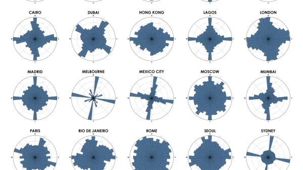
Chart Your City's Street Network to Understand its Logic
The roads in your city might conform to a grid, or they might divert around natural resources or landmarks. A new tool aims to help you visualize the "hidden logic" behind urban growth.

Redesign D.C.'s Metro With an Interactive Mapping Tool
Metro Map Maker allows users to add, alter, and erase pieces of the WMATA system—or redraw it from scratch.

The First U.S. 'Noise Map' Could Help Reduce Unsafe Exposure
A new tool from the Department of Transportation maps all the noise created by traffic nationwide.

Landlords Recoil from Property Data Websites
An apartment-hunting website that highlights landlords' credibility has not earned their cooperation.
What Are People Saying About Your Building Online?
Andrew Michler gives an overview of a brand new social networking platform that could reshape how we evaluate and compare buildings.
The Local Food Movement Goes Online
Online tools designed to connect local farmers with consumers are helping sustain the local food and urban agriculture movements.

FREE Course: Walkable City 1: Why Walkability?
After describing his path towards focusing on walkability as the essence of good planning, Jeff Speck marches through his five principal reasons for making more walkable places.
Reinventing Malls: Planning Alchemy—Turning Gray Fields Into Gold
The course focuses on the opportunities and imperatives that shape reinvention of mall sites.

City of Rosemead
Rutgers University, Edward J. Bloustein School of Planning and Public Policy
One Hundred Miles
Hunter College, City University of New York (CUNY)
The Architects Foundation
University of Cincinnati Online
City of Cambridge
Montrose County
The Pocatello Development Authority