University of Cincinnati
Master of Science in Geographic Information Systems - Online
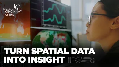
Geographic Information Systems (GIS) professionals play critical roles across urban planning, environmental analysis, public health, infrastructure development, emergency response, business intelligence, and countless other fields. The Master of Science in Geographic Information Systems (MS-GIS) from the University of Cincinnati, offered through UC Online, prepares graduates to meet this rising demand. The program features geospatial training, a flexible online curriculum, and hands-on experience with industry-standard tools.

This asynchronous program is built for working professionals and career changers seeking a practical and rigorous pathway into advanced GIS practice. There are no required live class sessions, and students can complete coursework on their own schedule—making it possible to balance academic goals with personal responsibilities from anywhere in the world.
A Comprehensive, Skills-Driven GIS Curriculum
The UC Online MS in GIS blends theory with sophisticated technical applications. Core curriculum areas include:
- Hydrology & GIS
- Remote Sensing & Image Analysis
- Crime Mapping & Predictive Spatial Analysis
- Analytical Cartography & Visualization
- Python Programming for GIS
- Spatial Databases & Data Management
- Web-Based GIS and Geospatial APIs

Students also have access to widely used software and environments such as ArcGIS Pro, ArcGIS Online, QGIS, remote sensing platforms, and Python libraries commonly used in geospatial modeling.
Throughout the program, students work with real datasets, engage in applied spatial problem-solving, and learn how to communicate insights effectively—skills directly transferable to planning agencies, environmental organizations, consulting firms, research institutions, public works departments, and private-sector employees.

Portfolio-Ready Capstone Experience
The degree culminates in a professional GIS capstone that allows each student to create a project demonstrating mastery of spatial analysis, cartography, and geospatial storytelling. Students may build a project rooted in their current role, develop a solution for a community partner, or integrate from an internship experience. Past student and faculty projects include environmental change detection studies, urban redevelopment analyses, crime pattern modeling, public health mapping, and climate-resilience spatial models.
This capstone component is a defining feature of this program, offering real-world relevance and a portfolio piece that supports career advancement.
Affordable Tuition & Strong Return on Investment
The University of Cincinnati is committed to making GIS education accessible. Tuition for the MS-GIS through UC Online is below the national average for comparable programs, making UC a competitive, cost-effective option for students seeking specialized geospatial training. This affordability is highlighted in our tuition graphic on this profile.
Students may also use employer tuition assistance programs, military education benefits, or payment plans to make graduate study financially manageable.

Admission & Start Dates
The program offers multiple start dates throughout the year, allowing students to begin at the time that best fits their schedule. Applicants must hold a bachelor's degree from a regionally accredited institution and submit official transcripts, a statement of purpose, and a resume. No GRE is required.
If you're interested, you can learn more or request details through our program's webpage here.
Find More Programs

University of Cincinnati
University of Cincinnati Online
College of Arts & Sciences
66 W Corry Street
Cincinnati, OH 45219
US
Other programs at this university
Find More Programs
University of Cincinnati
University of Cincinnati Online
College of Arts & Sciences
66 W Corry Street
Cincinnati, OH 45219
US