


After an unsuccessful attempt in 2007, the City is at it again, but doing so in stages. Already in use in limited areas like City Hall and public housing projects, Monday's Market Street roll-out creates a nexus between wifi and surface transit.
On Monday, the city officially began "San_Francisco_Free_WiFi" on the city's main transit corridor, Market Street, writes John Coté. It follows Muni's streetcar from Castro Street to the foot of Market Street at San Francisco Bay. [See map in The Castro Biscuit].


Coté writes that "(u)nlike the original citywide proposal [by former Mayor Gavin Newsom in 2007], which collapsed amid political bickering between the mayor and the Board of Supervisors and concerns over a city contract with EarthLink and Google, this network is constructed and owned by the city."
The foundation of the Market Street wi-fi coverage is provided by "fiber-optic cable along Market Street and connections to network equipment set up on traffic lights and other city-owned fixtures."
Unlike the prior attempt where it contracted with private companies, the city set up its own network at a cost of about $500,000 after donations from two Silicon Valley companies.
"It was simpler, faster, better to do it on our own," said Marc Touitou, whom (Mayor Ed) Lee appointed as the city's chief information officer in April. "The quality is higher, with the technical design by the Department of Technology. We wanted high capacity. ... We wanted it to be cool - no strings attached, no ads."
Coté notes that "despite its proximity to Silicon Valley and the city's tech boom, [San Francisco] is not at the top of the network chain domestically. Residents of both Kansas Cities and Provo, Utah, can get on Google's 1-gigabit fiber network, with Austin, Texas, on the way."
Correspondent's note: This post was prepared, with great patience due to a weak connection to "San_Francisco_Free_WiFi", from a bagel shop about 25 feet from Market Street.
FULL STORY: S.F. rolls out 3 miles of free Wi-Fi along Market Street

Tomorrow's Digital City Center: The Glasgow Agenda
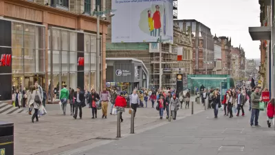
Take a walk around your downtown and what do you see. Most people are attached to their mobile phones, using them for directions, searching, and texting. See how can cities leverage digital technology to create a more engaging city center.
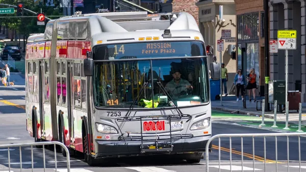
How to Fund SF’s Muni Without Cutting Service
Three solutions for bridging the San Francisco transit agency’s budget gap without reducing service for transit-dependent riders.

San Francisco's School District Spent $105M To Build Affordable Housing for Teachers — And That's Just the Beginning
SFUSD joins a growing list of school districts using their land holdings to address housing affordability challenges faced by their own employees.

Planetizen Federal Action Tracker
A weekly monitor of how Trump’s orders and actions are impacting planners and planning in America.

Map: Where Senate Republicans Want to Sell Your Public Lands
For public land advocates, the Senate Republicans’ proposal to sell millions of acres of public land in the West is “the biggest fight of their careers.”

Restaurant Patios Were a Pandemic Win — Why Were They so Hard to Keep?
Social distancing requirements and changes in travel patterns prompted cities to pilot new uses for street and sidewalk space. Then it got complicated.

Platform Pilsner: Vancouver Transit Agency Releases... a Beer?
TransLink will receive a portion of every sale of the four-pack.

Toronto Weighs Cheaper Transit, Parking Hikes for Major Events
Special event rates would take effect during large festivals, sports games and concerts to ‘discourage driving, manage congestion and free up space for transit.”

Berlin to Consider Car-Free Zone Larger Than Manhattan
The area bound by the 22-mile Ringbahn would still allow 12 uses of a private automobile per year per person, and several other exemptions.
Urban Design for Planners 1: Software Tools
This six-course series explores essential urban design concepts using open source software and equips planners with the tools they need to participate fully in the urban design process.
Planning for Universal Design
Learn the tools for implementing Universal Design in planning regulations.
Heyer Gruel & Associates PA
JM Goldson LLC
Custer County Colorado
City of Camden Redevelopment Agency
City of Astoria
Transportation Research & Education Center (TREC) at Portland State University
Camden Redevelopment Agency
City of Claremont
Municipality of Princeton (NJ)