"Building Climate Resilience in Cities" was developed by global insurers and non profits to offer tools and technical assistance to urban areas facing development changes in response to climate change risks.


In the wake of Super Typhoon Haiyan and the 1 year anniversary of Superstorm Hurricane Sandy, global metropolises are struggling to end the climate change debate and focus on climate change solutions. In a unique overlap of interest,s non profits and global insurance agencies have teamed together to create a framework for assessing risk which if implemented, could save lives and dollars.
The new report provides a scaled prioritization list, a strategic planning framework, and a toolkit for local communities to host workshops with multiple stakeholders in their redevelopment process. The report aims to find a common global method for evaluating and addressing climate risk in response to the increasing frequency of catastrophic storms. As megalopolises are frequently located in coastal areas and represent ties to international communities, this framework addresses the multinational impact of and response to storms in urban economic centers.
Insurers have a role to play alongside planners and policy makers by setting the rates which determine which, if any, populations can live in coastal areas. Ceres, an American NGO, recognized this role and took the initiative to expand the alliance of stakeholders in climate change risk assessment and management. This global initiative is the first step in aligning global with local policy for adaptation planning.
Read the full story: Insurers, non-profits offer new resources on building resilient cities in face of climate risks
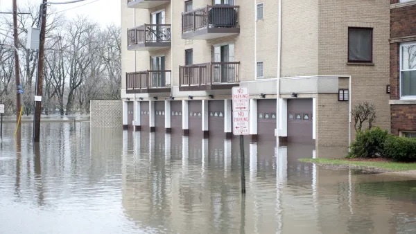
New Study Reveals Massive, Unaccounted Flood Risk
The Federal Emergency Management Agency undercounts the humber of homes at substantial risk of flooding by some 70 percent, according to a report released this week.

Preparing Boston for Future Floods
Boston Mayor, Martin Walsh's, climate change plan is one of the most thorough in the country. The question remains: Will any of the plan be put into action?
In a Warmer, Wetter and More Disaster-prone World: “Nature is the Greatest Designer”
A conversation with the American Society of Landscape Architects’ CEO Torey Carter-Conneen and board president Kona Gray.

Planetizen Federal Action Tracker
A weekly monitor of how Trump’s orders and actions are impacting planners and planning in America.

Eastern Nebraska is running out of electricity
Data centers and electrification are straining eastern Nebraska’s grid, throttling economic development.

Study reveals best places in the U.S. for cycling, walking
New research from Streetlight Data examines bicycle and pedestrian miles per capita in the 100 largest U.S. cities by population.

DSA members accuse Mamdani of 'abandoning values' over housing redevelopment
New York City's mayor plans to replace about 2,000 units of public housing with private, mixed-income housing.

All sides of BRT debate unhappy with CDOT’s most recent move
The Colorado Department of Transportation is no longer considering center-running bus lanes for Colorado Boulevard.

Massachusetts bogs generate both power, and cranberries
Putting solar panels above farmland is one way Massachusetts is advancing toward its goal of net-zero carbon emissions by 2050.

FREE Course: Walkable City 1: Why Walkability?
After describing his path towards focusing on walkability as the essence of good planning, Jeff Speck marches through his five principal reasons for making more walkable places.
Reinventing Malls: Planning Alchemy—Turning Gray Fields Into Gold
The course focuses on the opportunities and imperatives that shape reinvention of mall sites.

City of Rosemead
Rutgers University, Edward J. Bloustein School of Planning and Public Policy
One Hundred Miles
University of Michigan School for Environment and Sustainability (SEAS)
Hunter College, City University of New York (CUNY)
The Architects Foundation
City of Cambridge
The Pocatello Development Authority
The Urban Renewal Agency of the City of Pocatello