


Our annual list of the 10 best planning, design, and development websites represents some of the top online resources for news, information and research on the built environment.
![]()
Every year, Planetizen recognizes ten websites as some of the best resources for urban planning, design and development. This list is based on nominations by Planetizen readers and staff, and judged against a common set of criteria, including content, design, and usability. We've listed the websites alphabetically, not in a particular order of rank.
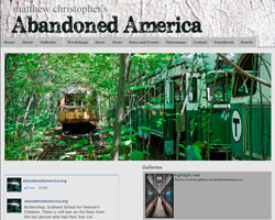 Abandoned America
Though Detroit may be the birthplace of “ruin porn”, the city is far from the only place in America to suffer from the decline and decay of its industrial, cultural, and social institutions. Matthew Christophe has made it his mission to document the “mesmerizing beauty and lost history” embodied in abandoned buildings throughout the United States. Rather than reveling in the decay, the site’s stunning photographs are meant to advocate rehabilitation and reuse, and “foster civic pride and partnership in these vestiges of bygone eras.”
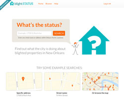 BlightStatus
Developed by a group of fellows from Code for America, the leaders in civic technology, BlightStatus exemplifies how digital tools are being deployed to help citizens become more knowledgeable, engaged, and proactive in urban improvement efforts. Created for residents of New Orleans, BlightStatus is a website and information service that allows users to look up information on blighted properties in their communities, and to keep updated on what the city is doing to clean them up.
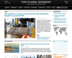 The Global Urbanist
Since 2009, The Global Urbanist has been covering issues related to urban development from a unique perspective. Founded by alumni of urban policy and international development programs at the London School of Economics and Political Science (LSE), the online magazine pays particular attention to issues impacting cities in the developing world, making it especially relevant in our age of rapid urbanization. The Global Urbanist is an invaluable tool for outsiders wishing to understand how informal economies, ad-hoc design, and the politics of place function in the world's informal cities.
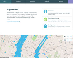 MapBox
At the same time that the big players in digital mapmaking (Google, Apple, etc.) are ramping up their efforts to out-do each other, open and crowdsourced services are shaking the industry’s foundations. One upstart in the bottom-up mapmaking movement is MapBox, a build-it-yourself mapping system. They offer street, terrain, and satellite maps that are easy to customize and integrate with a variety platforms. MapBox Streets is powered by OpenStreetMap, the popular crowdsourced map.
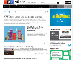 NPR Cities
A special series that started last summer and has continued over the past year, “NPR Cities: Urban Life in the 21st Century” brings National Public Radio’s peerless reporting to topics related to cities. Using twitter roundtables, audio reports, and user contributions, NPR looks at current trends and future challenges in the world's cities, which they call the "defining trait of humanity”. Current reporting is focused on “how cities are testing technology in an effort to increase efficiency and become more responsive to citizens.”
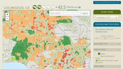
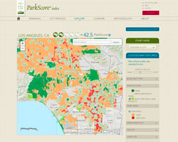 ParkScore
Want to know where your city ranks in terms of its provision of parks? Developed by The Trust for Public Land, ParkScore is “the most comprehensive rating system ever developed to measure how well the 50 largest U.S. cities are meeting the need for parks.” Rather than just a tool for measuring what amenities a city has, it also provides detailed data about what is missing, helping residents and city leaders to identify ways to improve their park systems. In 2013, the second year that rankings were released, Minneapolis topped the list.
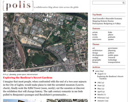 Polis
Polis
Looking for an international, often on-the-ground perspective on issues impacting cities around the globe? With contributions from experts and enthusiasts alike, this "inclusive blog" dedicated to "facilitating dialogue and collaboration toward improving the quality of life in cities" has you covered. The settings for recent posts reads like a catalog of global urban hotspots: São Paulo, Moscow, Mumbai, Istanbul.
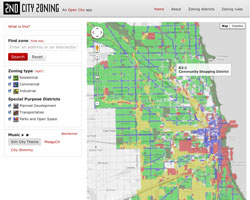 2nd City Zoning
Inspired by the classic video game Sim City - the entry-point for millions of gamers to the world of urban planning - the Chicago-based civic tech collective Open City has developed 2nd City Zoning. The site utilizes plain language, simple graphics and a user-friendly interface to “make zoning — one of the most important forces shaping cities, and yet one of the most impenetrable — digestible by humans," says Open City member Juan-Pablo Velez. The interactive map lets users find out how their building is zoned, learn where to locate their business, and explore zoning patterns throughout Chicago.
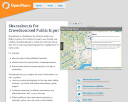 Shareabouts
In their mission to merge governance, planning, technology, and public participation, the civic tech gurus at OpenPlans have created Shareabouts, a flexible tool for gathering public input through a user-friendly map interface. By placing pins onto interactive maps, users can provide ideas, suggestions, and comments for planning and design issues. Shareabouts has been used for crowdsourcing locations for Chicago’s bike share system, collecting metrics about park usage in Philadelphia, and gathering public input on a comprehensive plan and zoning update in Mansfield, Connecticut, and many more outreach efforts.
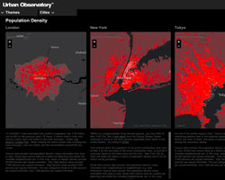 Urban Observatory
Richard Saul Wurman, the creator of the TED conference, has been interested in being able to compare cities at the same scale for more than 50 years. But only recently was he able to create a means to effectively, and attractively, display comparative patterns. Wurman, Jon Kamen of Radical Media, and Esri president Jack Dangermond, have together created the Urban Observatory, an innovative and beautiful online mapping tool for comparing 16 global cities along 16 data points, including: population density, open space, and traffic. The Urban Observatory also has a physical component, a multi-screen installation that was unveiled at this year’s Esri International Users Conference in San Diego.


Top Websites for Urban Planning - 2022
Every year, Planetizen collects the websites breaking new digital ground in the world of planning and related fields.
Top Websites for Urban Planning – 2021
Planetizen's annual list of the best of the urban planning Internet.
Top Websites for Urban Planning – 2020
Planetizen's annual list of the best of the planning Internet in a year inextricably defined by the uncertainty and constraints of the COVID-19 pandemic.

Planetizen Federal Action Tracker
A weekly monitor of how Trump’s orders and actions are impacting planners and planning in America.

San Francisco's School District Spent $105M To Build Affordable Housing for Teachers — And That's Just the Beginning
SFUSD joins a growing list of school districts using their land holdings to address housing affordability challenges faced by their own employees.

The Tiny, Adorable $7,000 Car Turning Japan Onto EVs
The single seat Mibot charges from a regular plug as quickly as an iPad, and is about half the price of an average EV.

As Trump Phases Out FEMA, Is It Time to Flee the Floodplains?
With less federal funding available for disaster relief efforts, the need to relocate at-risk communities is more urgent than ever.

With Protected Lanes, 460% More People Commute by Bike
For those needing more ammo, more data proving what we already knew is here.

In More Metros Than You’d Think, Suburbs are Now More Expensive Than the City
If you're moving to the burbs to save on square footage, data shows you should think again.
Urban Design for Planners 1: Software Tools
This six-course series explores essential urban design concepts using open source software and equips planners with the tools they need to participate fully in the urban design process.
Planning for Universal Design
Learn the tools for implementing Universal Design in planning regulations.
Smith Gee Studio
City of Charlotte
City of Camden Redevelopment Agency
City of Astoria
Transportation Research & Education Center (TREC) at Portland State University
US High Speed Rail Association
City of Camden Redevelopment Agency
Municipality of Princeton (NJ)