


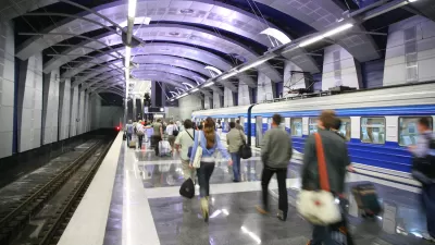
Congratulations to this year's high school, college and university graduates! The current crop includes our son, who was recruited by a major corporation. The location of his new job will affect his travel patterns and therefore the transportation costs he bears and imposes for the next few years: until now he could get around fine by walking, cycling and public transport, but his new worksite is outside the city center, difficult to access except by automobile. As a result he will spend a significant portion of his new income to purchase and operate a car, and contribute to traffic congestion, parking costs and pollution. This is an example of how land use decisions, such as where corporations locate their offices, affects regional transport patterns and costs.

Congratulations to this year's high school, college and university graduates! The current crop includes our son, who was recruited by a major corporation. The location of his new job will affect his travel patterns and therefore the transportation costs he bears and imposes for the next few years: until now he could get around fine by walking, cycling and public transport, but his new worksite is outside the city center, difficult to access except by automobile. As a result he will spend a significant portion of his new income to purchase and operate a car, and contribute to traffic congestion, parking costs and pollution. This is an example of how land use decisions, such as where corporations locate their offices, affects regional transport patterns and costs. It illustrates research showing that where people work and shop has as much impact on their travel habits as where they live.
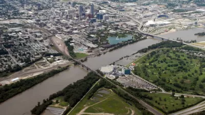
Other recent research offers additional insights. A report titled Land
Use and Traffic Congestion, published by the Arizona Department of
Transportation, is changing the way we think about congestion and solutions. It found that residents of
higher-density neighborhoods in Phoenix, Arizona drive substantially less than
otherwise similar residents located in lower-density, automobile-dependent suburban neighborhoods.
For example, the average work trip was a little longer than seven miles for
higher-density neighborhoods compared with almost 11 miles in more suburban
neighborhoods, and the average shopping trip was less than three miles compared
with over four miles in suburban areas. These differences result in urban
dwellers driving about a third fewer daily miles than their suburban
counterparts.
That is unsurprising. There is plenty of evidence that land use
factors such as density, mix and road connectivity affect the amount people travel.
However, the study made an important additional discovery. It found that roadways in more compact, mixed, multi-modal communities tend
to be less congested.
This results from the lower vehicle trip generation, particularly for local
errands, more walking and public transit travel, and because the more connected street networks offer more route
options so traffic is less concentrated on a few urban arterials. This
contradicts our earlier assumptions.
In the past experts often assumed that, although more
compact development increases overall accessibility (it increases the number of
goods and activities within an area and therefore reduces the travel costs
required to reach them), it increases local roadway congestion intensity,
a point used to criticize
smart growth.
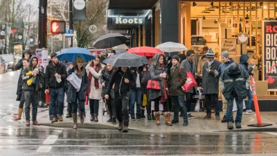
It turns out that this criticism is untrue. It fails to
account for real world conditions. Not only does smart growth significantly reduce
automobile trips, by offering better accessibility options it allows people to
respond to congestion by shifting mode and route. For example, when congestion
is a problem you walk or bike to local stores rather than driving to a more
distant shopping center, some commuters shift to alternative modes, and
motorists can shift to less congested routes for some trips. These solutions are not possible on newer suburban communities where
destinations are dispersed; walking, cycling and public transport inferior; and
hierarchical road networks channel all traffic onto major arterials.
This has important implications for transport and land use
planning. It indicates that smart growth development policies have smaller
costs and greater benefits than usually recognized, including local and
regional traffic congestion reductions, but it also indicates that these
benefits are contingent; they require an integrated set of policies including
increased density, mix, connectivity and transport options. As a result, the best response to smart growth criticism is more smart growth, for example, more density and mix, additional pedestrian and public
transit improvements, more connected transport networks, more parking management, and additional incentives to shift travel mode.
Critics often assume that
smart growth consists only of increased development density. If that were true
then some of their criticisms could have merit, but it is inaccurate, as discussed in a previous column, An Inaccurate Attack On Smart Growth. Smart growth involves a combination of increased development density and mix, more connected paths and roads, and improved transport options. Together, these land use reforms can provide a host of direct and indirect benefits.
For more information
Md Aftabuzzaman, Graham Currie and Majid
Sarvi (2011), "Exploring The Underlying Dimensions Of Elements Affecting
Traffic Congestion Relief Impact Of Transit," Cities, Vol. 28, Is. 1 (www.sciencedirect.com/science/journal/02642751),
February, Pages 36-44.
Wendell Cox (2003), How Higher Density
Makes Traffic Worse, Public Purpose (www.publicpurpose.com/pp57-density.htm).
J. Richard Kuzmyak (2012), Land Use and Traffic Congestion, Report
618, Arizona Department of Transportation (www.azdot.gov);
at www.azdot.gov/TPD/ATRC/publications/project_reports/PDF/AZ618.pdf.
J. Richard Kuzmyak, Jerry Walters, Hsi-hwa
Hu, Jason Espie, and Dohyung Kim (2012), Travel
Behavior and Built Environment: Exploring the Importance of Urban Design at the
Non-Residential End of the Trip, Lincoln Institute of Land Policy (www.lincolninst.edu); at www.lincolninst.edu/pubs/dl/2057_1379_Kuzmyak%20WP12RK1.pdf.
Todd Litman (2011), Smart
Congestion Relief: Comprehensive Analysis Of Traffic Congestion
Costs and Congestion Reduction Benefits, Victoria
Transport Policy Institute (www.vtpi.org); at
www.vtpi.org/cong_relief.pdf.

Analyzing Accessibility Disparities
With better planning we can reduce disparities between drivers and non-drivers in their ability to access services and jobs, improving fairness and economic opportunities for disadvantaged groups.
Omaha's Transit Agency Plans to Expand, Enhance Service
The plan calls for more frequent service, expanded bus lines, and connectivity between different modes of transit.
A New App Helps Identify 15-Minute City
The new 15-Minute City App generates maps which show the number of services and activities within a 15 minute walk, and and therefore whether an area can be considered a 15-minute neighborhood.

Trump Administration Could Effectively End Housing Voucher Program
Federal officials are eyeing major cuts to the Section 8 program that helps millions of low-income households pay rent.

Planetizen Federal Action Tracker
A weekly monitor of how Trump’s orders and actions are impacting planners and planning in America.

Ken Jennings Launches Transit Web Series
The Jeopardy champ wants you to ride public transit.

Driving Equity and Clean Air: California Invests in Greener School Transportation
California has awarded $500 million to fund 1,000 zero-emission school buses and chargers for educational agencies as part of its effort to reduce pollution, improve student health, and accelerate the transition to clean transportation.

Congress Moves to End Reconnecting Communities and Related Grants
The House Transportation and Infrastructure Committee moved to rescind funding for the Neighborhood Equity and Access program, which funds highway removals, freeway caps, transit projects, pedestrian infrastructure, and more.

From Throughway to Public Space: Taking Back the American Street
How the Covid-19 pandemic taught us new ways to reclaim city streets from cars.
Urban Design for Planners 1: Software Tools
This six-course series explores essential urban design concepts using open source software and equips planners with the tools they need to participate fully in the urban design process.
Planning for Universal Design
Learn the tools for implementing Universal Design in planning regulations.
Heyer Gruel & Associates PA
Ada County Highway District
Institute for Housing and Urban Development Studies (IHS)
City of Grandview
Harvard GSD Executive Education
Toledo-Lucas County Plan Commissions
Salt Lake City
NYU Wagner Graduate School of Public Service