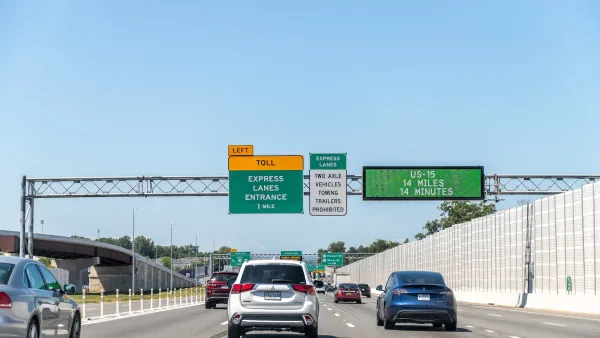
Transportation concurrency is the subject of a bill that has passed one house of the Florida legislature. "Concurrency" is the Florida term for "adequate public facilities controls," indicating that facilities need not necessarily be in place at the time of project approval but that they must be scheduled to become available "concurrently" with demand from proposed development.



Transportation concurrency is the subject of a bill that has passed one house of the Florida legislature. "Concurrency" is the Florida term for "adequate public facilities controls," indicating that facilities need not necessarily be in place at the time of project approval but that they must be scheduled to become available "concurrently" with demand from proposed development.
The bill would significantly limit the effect of transportation concurrency in metropolitan areas, a concept that has been publicly supported by Tom Pelham, a long-time growth management advocate and once again Secretary of the state's Department of Community Affairs.
Why would a growth management advocate support a weakening of a growth management tool? Concurrency requirements can have unintended consequences. The goal of most growth management and smart growth programs is to encourage compact development that is contiguous to or part of an existing urbanized area. Those are precisely the areas that are most likely to be congested. Thus, to meet transportation concurrency requirements, developers often leapfrog out to rural areas with little congestion. The result, of course, is sprawl of the worst sort, triggering in most cases an increase in vehicle miles traveled.
Several years ago I was consulting with a prosperous, close-in suburb in the Middle Atlanctic states. Most commuting in that part of the region occurred on state highways, several of which passed through the community. Public officials were determined to impose adequate public facilities controls that would include standards related to congestion on those roads. I pointed out to them that the net effect of denying development approval to a project in their community would be to push that development to a suburb further out, with residents of the new development still passing through the community on those same state highways but with the local government having no control over the quality of the development. They did not take my advice, which was certainly their privilege, but it appears that the Florida legislature -- with more experience of the unintended consequences -- got the message.
Are adequate public facilities controls or concurrency requirements a bad idea? No. It is irresponsible to approve a new development that manages to meet local subdivision standards but that will add 400 or 500 peak hour trips to a 1 1/2 lane gravel road that provides the only access to the subdivision. But as planners we need to work through the logical consequences of what we recommend. One thing that we have learned is that congestion is a great tool for transportation demand management and that road congestion can encourage people to use rail transit where it is available. We cannot foresee every consequence of every planning proposal, but we need to learn from the experiences of others and educate the local planning process.
Congestion Costing Reality Check, Part 2: A congestion costing critique
There are good reasons to be skeptical of highway industry claims that traffic congestion is a growing problem. Their analysis is often incomplete and biased. Let’s pull back the curtain on some major congestion cost studies.

Congestion Growing in Sunbelt Cities
Cities with rapidly growing populations and inadequate public transit systems are seeing more gridlock despite changes in commuting patterns and the rise of remote work.

Will Autonomous Cars Live Up to Their Potential?
A new report details the promise and perils of the growing autonomous vehicle industry.

Planetizen Federal Action Tracker
A weekly monitor of how Trump’s orders and actions are impacting planners and planning in America.

Eastern Nebraska is running out of electricity
Data centers and electrification are straining eastern Nebraska’s grid, throttling economic development.

Study reveals best places in the U.S. for cycling, walking
New research from Streetlight Data examines bicycle and pedestrian miles per capita in the 100 largest U.S. cities by population.

DSA members accuse Mamdani of 'abandoning values' over housing redevelopment
New York City's mayor plans to replace about 2,000 units of public housing with private, mixed-income housing.

All sides of BRT debate unhappy with CDOT’s most recent move
The Colorado Department of Transportation is no longer considering center-running bus lanes for Colorado Boulevard.

Massachusetts bogs generate both power, and cranberries
Putting solar panels above farmland is one way Massachusetts is advancing toward its goal of net-zero carbon emissions by 2050.

FREE Course: Walkable City 1: Why Walkability?
After describing his path towards focusing on walkability as the essence of good planning, Jeff Speck marches through his five principal reasons for making more walkable places.
Reinventing Malls: Planning Alchemy—Turning Gray Fields Into Gold
The course focuses on the opportunities and imperatives that shape reinvention of mall sites.

City of Rosemead
Rutgers University, Edward J. Bloustein School of Planning and Public Policy
One Hundred Miles
University of Michigan School for Environment and Sustainability (SEAS)
Hunter College, City University of New York (CUNY)
The Architects Foundation
City of Cambridge
The Pocatello Development Authority
The Urban Renewal Agency of the City of Pocatello

