


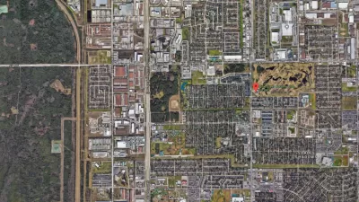
New modeling software could soon be available that would allow monitoring across the internet of flood levels in specific areas- like your backyard.
"The images are all too familiar: overtopped levees, homes submerged in floodwaters, rescuers motoring down city streets in fishing boats. This summer, before the muck had even been cleared from neighborhoods in the heart of the Midwest, the question resurfaced: What happened? Three years after Hurricane Katrina, and 15 years after disastrous flooding throughout the Midwest, how could the country allow rising waters to kill at least 24 people and cause billions in damage to structures and crops? And the Mississippi Basin isn't the only region at risk. Aging flood walls protect areas from California's Sacramento–San Joaquin River Delta to the shores of Florida's Lake Okeechobee, threatening future devastation. For many, the answer seems clear. Raise levees high enough to ensure that no flood ever wreaks havoc again.
Unfortunately, it's not so simple. For one thing, it's unclear just how high levees should be built. "In Cedar Rapids [Iowa], nobody would have dreamed the river could get that high," says Jeffrey Schott, an instructor of urban and regional planning at the University of Iowa in Iowa City, where 21 buildings were flooded. The flood walls in Cedar Rapids, which had been built to a so-called 100-year standard, were overwhelmed by water that rose to a 500-year level. (The language is misleading: The next "500-year flood" could come next spring.)
'After '93, we could have built the levees in the Midwest 10 ft. higher, for example,' says Robert Holmes, national flood specialist for the United States Geological Survey. 'But the cost far exceeds the benefit.'"
FULL STORY: Thinking Beyond Levees, Experts Turn to New Flood Software

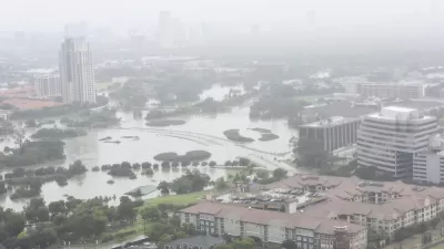
800 New Homes Approved for Houston's Floodplain
The city of Houston approved a new development that doesn't meet new elevations standards approved by the city of Houston earlier this month.
Houston Seriously Tightens Rules on Floodplain Construction
It was the city's "first major regulatory response" to Hurricane Harvey.
Flood Control Project On Death Bed
An Army Corps of Engineers flood control project in south-central Mississippi is in danger of being vetoed by the U.S. Environmental Protection Agency. But supporters have not given up hope.

Maui's Vacation Rental Debate Turns Ugly
Verbal attacks, misinformation campaigns and fistfights plague a high-stakes debate to convert thousands of vacation rentals into long-term housing.

Planetizen Federal Action Tracker
A weekly monitor of how Trump’s orders and actions are impacting planners and planning in America.

San Francisco Suspends Traffic Calming Amidst Record Deaths
Citing “a challenging fiscal landscape,” the city will cease the program on the heels of 42 traffic deaths, including 24 pedestrians.

Defunct Pittsburgh Power Plant to Become Residential Tower
A decommissioned steam heat plant will be redeveloped into almost 100 affordable housing units.

Trump Prompts Restructuring of Transportation Research Board in “Unprecedented Overreach”
The TRB has eliminated more than half of its committees including those focused on climate, equity, and cities.

Amtrak Rolls Out New Orleans to Alabama “Mardi Gras” Train
The new service will operate morning and evening departures between Mobile and New Orleans.
Urban Design for Planners 1: Software Tools
This six-course series explores essential urban design concepts using open source software and equips planners with the tools they need to participate fully in the urban design process.
Planning for Universal Design
Learn the tools for implementing Universal Design in planning regulations.
Heyer Gruel & Associates PA
JM Goldson LLC
Custer County Colorado
City of Camden Redevelopment Agency
City of Astoria
Transportation Research & Education Center (TREC) at Portland State University
Jefferson Parish Government
Camden Redevelopment Agency
City of Claremont