


Ubiquitous access to GPS data and social software is generating a whole new breed of cartographers who are empowering themselves and others by mapping everything from community assets to occurrence of disease.
"Maps are everywhere these days. The ubiquity of global positioning systems (GPS) and mobile directional devices, interactive mapping tools and social networks is feeding a mapping boom. Amateur geographers are assigning coordinates to everything they can get their hands on-and many things they can't. "Locative artists" are attaching virtual installations to specific locales, generating imaginary landscapes brought vividly to life in William Gibson's latest novel, Spook Country. Indeed, proponents of "augmented reality" suggest that soon our current reality will be one of many "layers" of information available to us as we stroll down the street.
Multimedia designer Sha Sha Feng recently completed a Master of Fine Arts project at Hunter College in New York titled "MapaboutMaps," using Google Earth as a platform to host video interviews about new directions in mapping with geographers, artists and programmers.
Feng was particularly interested in examining the role maps can play in building community. She interviewed Wendy Brawer, the founder of Greenmap Systems, a website that engages local mapping teams to chart their communities' natural and green living landmarks, including farmers markets, organic food producers, fair trade shops, indigenous sites and the best spots for star-gazing. "Maps are very personal objects," says Brawer. "People look for themselves on them."
Participatory mapping tools have "opened the world of maps from a few to many," says Feng. "Maps are powerful tools. Many people take them as fact, but they tell the story that the creator wants you to see. Grassroots communities and artists welcome this technology because it allows their voices to be heard."
In many ways, these mapping tools are re-locating us as the center of our personal universes. We no longer go to maps to find out where we are. Instead, we tell maps where we are and they form around us on the fly, a sensation that can be comforting or stifling. After all, while finding the right map can orient you, having dozens can threaten to tip the signal-to-noise ratio toward cacophony.
On balance, though, the democratization of mapping and visualization tools generates possibilities for self-expression and social action. Two decades ago, postmodern theorist Frederic Jameson argued that developing new maps would be central for activists hoping to grapple with the emerging global business and communication systems. "[The] incapacity to map socially is as crippling to political experience as the analogous incapacity to map spatially is for urban experience," he wrote.
The tools are now available. The question now: Where do we go from here?"
FULL STORY: The New Cartographers
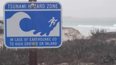
Washington State Requests Federal Funding for Tsunami Preparedness
The state’s Department of Natural Resources says it needs continued funding to map coastal areas at risk for tsunami impacts and prepare mitigation and evacuation plans.
New Book Highlights How GIS Improves Outcomes
Esri Press recently published a digital book called Mapping the Nation which demonstrates how a geographic approach guides important decisions and addresses challenges around the globe.
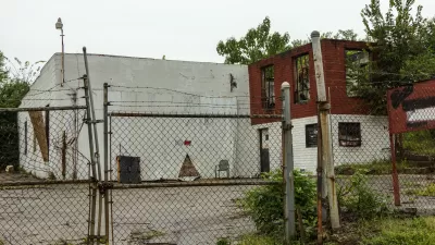
Map Identifies DeKalb County Brownfield Sites
The GIS tool is designed to help developers find vacant and blighted lots that could be restored for new housing or other uses.

Depopulation Patterns Get Weird
A recent ranking of “declining” cities heavily features some of the most expensive cities in the country — including New York City and a half-dozen in the San Francisco Bay Area.

California Exodus: Population Drops Below 39 Million
Never mind the 40 million that demographers predicted the Golden State would reach by 2018. The state's population dipped below 39 million to 38.965 million last July, according to Census data released in March, the lowest since 2015.

Pennsylvania Mall Conversion Bill Passes House
If passed, the bill would promote the adaptive reuse of defunct commercial buildings.

Google Maps Introduces New Transit, EV Features
It will now be easier to find electric car charging stations and transit options.

Ohio Lawmakers Propose Incentivizing Housing Production
A proposed bill would take a carrot approach to stimulating housing production through a grant program that would reward cities that implement pro-housing policies.

Chicago Awarded $2M Reconnecting Communities Grant
Community advocates say the city’s plan may not do enough to reverse the negative impacts of a major expressway.
City of Costa Mesa
Licking County
Barrett Planning Group LLC
HUD's Office of Policy Development and Research
Mpact Transit + Community
HUD's Office of Policy Development and Research
City of Universal City TX
ULI Northwest Arkansas
Town of Zionsville
Urban Design for Planners 1: Software Tools
This six-course series explores essential urban design concepts using open source software and equips planners with the tools they need to participate fully in the urban design process.
Planning for Universal Design
Learn the tools for implementing Universal Design in planning regulations.