Let's begin by killing off one of the cherished half-truths about Vancouver.Vancouver, it is said, is the only major city in North America without freeways.


Vancouver, it is said, is the only major city in North America without freeways.
Partly true. In the early 1970s, the citizens of this city, like many others in North America, killed the plans for a spoke-and-hub freeway network modelled on the American Interstate system that would have thrust through the inner-ring suburbs into the downtown core. And because Canada was some years behind the States and didn't have a federal Highway Trust Fund, no concrete was laid before the plans were scrapped.
But that was true only for the freeways that would have entered the City of Vancouver proper – just one of the 21 municipalities that make up Greater Vancouver. Elsewhere, the provincial and federal governments successfully laid asphalt for the Trans-Canada Highway and connections to I-5 at the border. And it was those freeways and the arterial grid that shaped the region's future: the suburbs beyond the traditional streetcar city would be designed and zoned on the assumption that almost everyone would drive everywhere for everything.
Today, most of Greater Vancouver looks indistinguishable from standard North American suburban sprawl - the city designed according to the ITE Handbook. When, in 1942, the Institute of Transportation Engineers consolidated the codes needed to ensure "the efficient, free and rapid flow of traffic," it created the template that the incorporating post-war suburbs could adopt as the basis for their urban planning.
The City of Vancouver, however, chose a different direction. All City Councils since the 1970s, regardless of ideology, have reiterated a policy that there will be no more room for single-occupancy vehicles: no more roads, not even any more road-widening, save for the few places not already developed. From then on, resources were increasingly devoted to a priority list that puts the pedestrian in first place, followed by cyclists, transit users, and then the car drivers.
And while critics would maintain that there hasn't been a full commitment to those priorities, the City was the first to introduce permanent traffic-calming in North America, a leader in developing high-density neighbourhoods organized around greenways, a leader in accessible design, a leader in developing a bikeway network, and, above all, a leader in saying no to more roads.
And Vancouver ended up being, by several surveys, the most livable city in the world.
Not a coincidence.
Unfortunately, the lessons were not taken seriously by the highway planners and politicians who still run the provincial Ministry of Transport. Successfully lobbied by the trucking lobby, road builders and business leaders, the province is fully committed to expanding the freeway system in almost every direction, locking the next generation into their cars and trucks. Even though they know it won't work, have nowhere to point to for a successful model, and don't care.
So now there are two Vancouvers, each heading in a different direction: one, with its 19th-century grid and streetcar fabric still intact, serving as a high-density model for the 21st century. The other, as the project manager for the freeway expansion recently said, "completing the transportation vision of the 1960s."

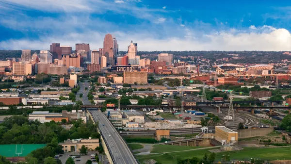
'Economic Mapping' to Help Regional Planning
Identifying potential hubs and activity centers allows regions to foster economic growth and density.

FresYes: How Fresno Fueled and Funded a Comeback
Recently termed-out Mayor Ashley Swearengin sits down for an exclusive interview about how she planned for high speed rail investments, championed sustainable water management, and took steps to rebuild the local economy.
A $350 Million Bond to Repair San Francisco's Seawall
As seas rise, San Francisco is looking to shore up its costal protection against earthquakes and extreme weather events.

Planetizen Federal Action Tracker
A weekly monitor of how Trump’s orders and actions are impacting planners and planning in America.
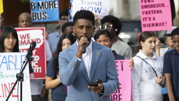
‘Going backwards:’ Baltimore mayor, students rally against state's transit funding plan
Maryland's proposed six-year plan provides no funding for Baltimore’s BMORE bus program and reduces its road maintenance funding.
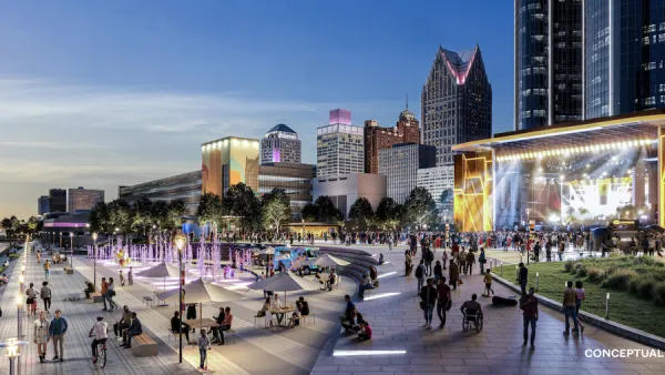
Detroit to transform waterfront with $2.2 billion investment
Developers will convert about 18 acres of unused parking lot space into civic spaces.

U.S.-Iran war may have ‘devastating’ impact on cost to warm homes
Vermont and Maine residents may see a 76% increase in the cost of warming their homes this winter.

Senate bill would ‘overhaul’ environmental permitting laws
Under the proposed act, government agencies would also not be able to suspend or rescind permits after granting them.

Exemption applications for NYC’s pied-à-terre tax see 55% success rate
The city sent nearly 40% of its initial pied-à-terre tax warnings erroneously.

FREE Course: Walkable City 1: Why Walkability?
After describing his path towards focusing on walkability as the essence of good planning, Jeff Speck marches through his five principal reasons for making more walkable places.
Reinventing Malls: Planning Alchemy—Turning Gray Fields Into Gold
The course focuses on the opportunities and imperatives that shape reinvention of mall sites.

One Hundred Miles
County of Mendocino
planning NEXT
The Architects Foundation
University of Cincinnati Online
Montrose County
Northern Illinois Transit Authority (NITA)
The Pocatello Development Authority

