


Data

How to Understand Your City's Eviction Crisis
Other cities could learn from efforts to lower eviction rates in Charlotte, North Carolina.
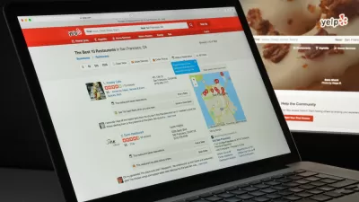
Using Yelp to Predict Gentrification
New research draws on the popular review site Yelp to predict changes in housing prices and demographics.

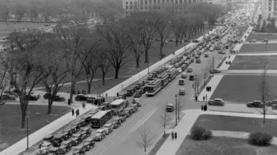
Changing Travel Behavior: We Are Traveling Less, and More
We are in perhaps the most dynamic period with respect to changes in travel behavior in the past 50 years. Chose your data wisely.

A New Treasure Trove of Data on Mobility Services Is Now Available for Researchers
A shared post by Regina Clewlow, CEO and founder of Populus.

Uber Releases Open-Source Mapping Tool
Individuals and major companies alike have already found a variety of applications for the software.

Census Bureau Serves Both Sides of the Housing Debate
The Census Bureau wants to be a friend to YIMBYs and NIMBYs alike.

California Evictions Much Faster and More Frequent Than Previously Thought
About 500,000 tenants face eviction every year—triple previous estimates. And over a million may be involuntary displaced despite never making it to court.

A Wetter Midwest Challenges Planning and Infrastructure
FiveThirtyEight explores how planners in the Midwest are trying to get ahead of an intensifying climate.

A New 'City Health Dashboard' for 500 U.S. Cities
The new City Health Dashboard might be the first time many communities have had access to a treasure trove of public health data at the click of a mouse button.

Anticipating Gentrification in Detroit
Where is gentrification most likely to occur in cities like Detroit? And how can that data guide policy? A new report provides some insight.
Chariot Gets a New Deal with San Francisco, Data Sharing Included
Ford-owned shuttle provider, Chariot, will be back on the streets in San Francisco after an October shutdown.
Effective Mobility Taxes Need Better Data
The District of Columbia is attempting to build a data-based model for the mix of public and "shared" transportation modes on its streets, but is still finding holes in the data necessary to build new policies.
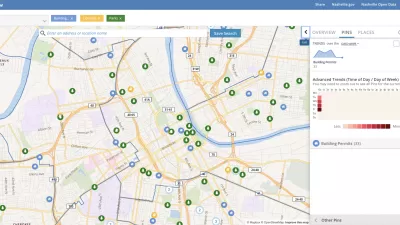
Presenting Municipal Data in an Interactive Map, Nashville Style
The city of Nashville launched the NashView interactive data map earlier this month.

Radar Speed Sign 2.0: How a Small Town Calmed Its Traffic
To get a handle on drivers whizzing through its main road, the small town of Betterton, Maryland installed a "smart" radar speed sign. The data it collected helped the local sheriff's department improve traffic enforcement.

Op-Ed: Time to Ditch the Old Data Used to Separate Gentrification From Displacement
Norman Oder asks readers to question the evidence traditionally cited in arguments that attempt to disprove displacement as a consequence of gentrification.

How London's Leading on Transit Data
Transport for London is forging ahead on several projects to collect and use more rider data. One initiative draws on WiFi connections to map users' paths through the London Underground.

The Artist Hubs of America
Data analysis reveals which cities have the most working artists.

Dearth of Data Masks Scale of Distracted Driving Fatalities
Bloomberg links the uptick in traffic fatalities throughout the United States to rising smartphone use while driving.
Mapping the Latest GDP Data for the Nation's Metropolitan Areas
Continuing Planetizen's survey of data dumps by the federal government is a post devoted to the gross domestic product (economic clout, in other words) of the country's metropolitan areas.
How Zillow's Approach to Data Reshaped the Real Estate Market
Zillow's chief analytics officer and chief economist offers insight into the company's approach to data, models, and the real estate market.
City of Costa Mesa
Licking County
Barrett Planning Group LLC
HUD's Office of Policy Development and Research
Mpact Transit + Community
HUD's Office of Policy Development and Research
Tufts University, Department of Urban and Environmental Policy & Planning
City of Universal City TX
ULI Northwest Arkansas
Urban Design for Planners 1: Software Tools
This six-course series explores essential urban design concepts using open source software and equips planners with the tools they need to participate fully in the urban design process.
Planning for Universal Design
Learn the tools for implementing Universal Design in planning regulations.


