


Boundaries
How Well Do You Know Your City's Boundaries?
A new crowdsourced map projects asks people to draw their city limits from memory.
Why We Should Plan According to Ecosystem, Rather Than Artificial Boundaries
The often arbitrary boundaries drawn up to define territory limits how most planners determine the extents of their projects. Neil Chambers argues why we, and the planet, would be better served if we planned according to natural characteristics.
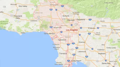
Defining The Neighborhood Through Mapping
In an effort to get a more precise look at the city and its distinct neighborhoods, the Los Angeles Times is starting a collaborative mapping project to set clear and adaptable boundaries for L.A.'s neighborhoods.
City of Costa Mesa
Licking County
Barrett Planning Group LLC
HUD's Office of Policy Development and Research
Mpact Transit + Community
HUD's Office of Policy Development and Research
City of Universal City TX
ULI Northwest Arkansas
Town of Zionsville
Urban Design for Planners 1: Software Tools
This six-course series explores essential urban design concepts using open source software and equips planners with the tools they need to participate fully in the urban design process.
Planning for Universal Design
Learn the tools for implementing Universal Design in planning regulations.


