


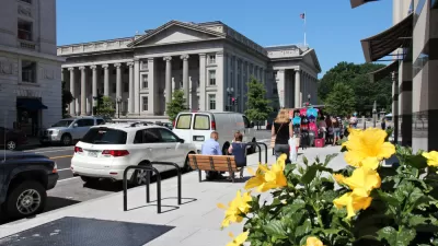
More uses and modes than ever are fighting for curb space in growing cities. Here's an app to make sense of what you can do, and when, along this valued real estate.

Andrew J. Hawkins shares news of a new tool released by Sidewalk Labs recently that makes visual sense of the way cities allow access to curb space lining busy streets.
According to Hawkins, "with the explosion of new mobility options like ride-hailing, car-sharing, and bike-sharing, and the looming specter of self-driving vehicles on the horizon, cities are starting to rethink how they allocate curb space."
Sidewalk Labs response to these changing dynamics is called Coord, a new company "focused on helping cities and mobility companies better manage traffic congestion and parking problems on their streets through a cloud-based platform."
"After digitizing the city’s curbs, including parking meters, parking signs, and curb stripes, Coord condensed all that data into a map that’s searchable by date, time, vehicle type, and desired action," adds Hawkins.
Coord released a map of San Francisco's curbsides to demonstrate the power of the idea. Hawkins outlines some use cases and previews the new mapping tool at the source article.
FULL STORY: Become a parking savant with Sidewalk Labs’ new curb visualization tool

How the Pandemic Is Reshaping Cities
The social and economic upheaval of the last two years accelerated a shift in thinking about how we use public space and organize the urban realm.

Pilot Projects Launched to Test Coordinated Curb Use
Coord, a Sidewalk Labs spinoff, has selected the winners of the inaugural Digital Curb Challenge.
Next on the List for Data Startups: Managing Curb Space
The humble curb is getting crowded: not only with new modes of transportation, but also with a slew of new data tools aiming to keep track of it all.

Pennsylvania Mall Conversion Bill Passes House
If passed, the bill would promote the adaptive reuse of defunct commercial buildings.

Planning for Accessibility: Proximity is More Important than Mobility
Accessibility-based planning minimizes the distance that people must travel to reach desired services and activities. Measured this way, increased density can provide more total benefits than increased speeds.

World's Largest Wildlife Overpass In the Works in Los Angeles County
Caltrans will soon close half of the 101 Freeway in order to continue construction of the Wallis Annenberg Wildlife Crossing near Agoura Hills in Los Angeles County.

Eviction Looms for Low-Income Tenants as Rent Debt Rises
Nonprofit housing operators across the country face almost $10 billion in rent debt.

Brightline West Breaks Ground
The high-speed rail line will link Las Vegas and the Los Angeles area.

Colorado Bans No-Fault Evictions
In most cases, landlords must provide a just cause for evicting tenants.
City of Costa Mesa
Licking County
Barrett Planning Group LLC
HUD's Office of Policy Development and Research
Mpact Transit + Community
HUD's Office of Policy Development and Research
Tufts University, Department of Urban and Environmental Policy & Planning
City of Universal City TX
ULI Northwest Arkansas
Urban Design for Planners 1: Software Tools
This six-course series explores essential urban design concepts using open source software and equips planners with the tools they need to participate fully in the urban design process.
Planning for Universal Design
Learn the tools for implementing Universal Design in planning regulations.