


Data

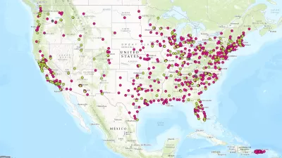
Who's Mapping Gentrification, and Where?
In these cities, data on gentrification has been compiled to build mapping tools documenting the process. The hope is to identify neighborhoods where low-income residents are at risk of displacement.

Internet of Things Brings More Surveillance and Vulnerabilities to Cities
Too often, smart city technology is described as an innocuous tool, but Adam Greenfield argues the technology acquiring this data will be used to distribute city resources, an inherently political act.

The First U.S. 'Noise Map' Could Help Reduce Unsafe Exposure
A new tool from the Department of Transportation maps all the noise created by traffic nationwide.

Trump Administration's Draft Budget Raises New Concerns About Data Collection
President Trump has made no secret of his disdain for many of the traditional data points used to represent the health and prosperity of the country. The budgetary process offers an opportunity to match words with action.

All the Reasons to Map a City's Smells
"Smell-mapping" is gaining attention from urban planners, data scientists, and nature conservationists alike.
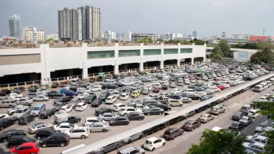
App Detects Open Parking Spaces with 99% Accuracy
Technology startup Parkifi seeks to use the Internet of Things to address the long-lamented problem of congestion created by drivers seeking parking.
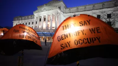
Visualizing Gentrification in 9 Cities
A new atlas explores the multiple causes of gentrification through bold graphics and data visualizations.

Is a Universal Metric for Gentrification Possible?
The Guardian’s new "Gentrified World" series tackles a fundamental—but tricky—question: How can we measure gentrification?

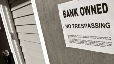
Study Opens Doors to Better Eviction Data Nationwide
A survey of renters' housing history in Milwaukee could completely change what we know about eviction in the United States.

Commuting in America 2015
Is commuting Deplorable? Can we Make Commuting Great Again? It is sometimes necessary to resort to hyperbole to draw attention to real data.

A One-Stop Shop for Transportation Data
The Transport Politic has announced the new Transport Databook, with is a kind of treasure trove of data.
Hot Off the Press: The National Transit Map
The U.S. Department of Transit has released its first ever National Transit Map.

Los Angeles' Chief Technology Officer Helped to Connect City on Transit and Transparency
Chief Innovative Technology Officer of Los Angeles, Peter Marx, recently stepped down. But first, he offers some lessons learned during his tenure, which included an L.A. mobility app and a successful open data initiative.

Map-Correcting App Shows 'The True Size Of' Places
Typical world maps badly misrepresent the size of countries; a new web app shows their true scale.

Bike Advocates Hone Data Tools
NextCity surveys a variety of new data-collecting technologies meant to clarify the impacts of bike and pedestrian infrastructure projects.
Mapping Tool Enables Housing Action in Detroit and Beyond
A web tool that helped Detroit develop a housing plan may ultimately provide public data on every parcel in the country.
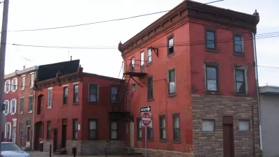
Real-Estate Site Locates Redevelopment Potential Across Philadelphia
A new map-based web tool created by a former city employee calculates the redevelopment potential of every parcel in Philadelphia.

How (and Why) to Start a Local Data Intermediary
A new guide helps communities set up groups that can help analyze their neighborhood data and put it to good use.
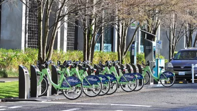
Asking the Right Questions About Equity In Bikeshare
The way we measure the success of bikeshare systems could be giving us the wrong idea about their impacts, and about the transportation needs of low-income areas.

DataUSA: An Intuitive Tool for Public Data
A collaboration between Deloitte, Datawheel, and MIT has produced an intuitive aesthetically-pleasing gathering point for public data in the United States. Specific locations and industries boast easy-to-read profiles.
City of Costa Mesa
Licking County
Barrett Planning Group LLC
HUD's Office of Policy Development and Research
Mpact Transit + Community
HUD's Office of Policy Development and Research
Tufts University, Department of Urban and Environmental Policy & Planning
City of Universal City TX
ULI Northwest Arkansas
Urban Design for Planners 1: Software Tools
This six-course series explores essential urban design concepts using open source software and equips planners with the tools they need to participate fully in the urban design process.
Planning for Universal Design
Learn the tools for implementing Universal Design in planning regulations.


