


Navigation
Making Trip Planning Easier for Vision-Impaired Transit Riders
The app provides navigation using audio and haptic cues to improve accessibility for people with low vision.

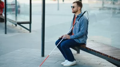
New App Helps People With Visual Impairments Navigate Transit
The Waymap app offers precise instructions to give blind pedestrians more options for safe travel.
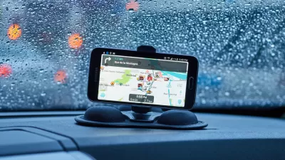
Google Maps for iPhone Now Reports DUI Checkpoints, Speed Traps
Navigation app Waze has long allowed users the ability to report various "inconveniences" on the road, like speed traps, checkpoints, and crashes. Now Google Maps users on iPhone can do the same.
Mobility Data: How Your Travel Patterns Could Inform Policy
Data generated by travel modes can inform planners and regulators in improving the transportation system, but private mobility companies often restrict their access for concerns about privacy and competition.

Google's New 'Visual Position System' Takes Pedestrian Navigation to the Next Level
In case you've ever felt like Google Maps isn't as helpful on foot as it is in a car, there's a new technology just for you.
Google Maps Goes Multi-Modal
A bunch of new features makes Google Maps user-friendly for transit commuters.
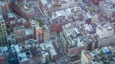
How an Urban Grid Becomes a Maze
Many rational, open grids can seem like a labyrinth to users. The labyrinth has emerged as an unplanned consequence of the evolution of cities, but solutions like GPS navigation and autonomous vehicles could mean relief.
Flooded With Navigation App Users, a Town Closes Its Streets
Navigation apps like Waze often reroute drivers onto residential streets that would be quiet otherwise. With some residents unable to leave their driveways, the New Jersey borough of Leonia has taken an extreme measure against the problem.
Cities Seeking New Weapons in the Battle Against Waze-Induced Traffic
Los Altos, California has erected a new roadblock in its ongoing effort to keep drivers from cutting through residential neighborhoods, beckoned by the popular navigation app Waze.
Waze vs. Residential Neighborhoods
Accounts of disgruntled residents responding by any means necessary to the flood of cars beckoned by the whims of navigation apps like Waze are spreading across the country.
Ultimate Tech Guide to Boston
Whether you're a lifelong resident of Boston, just moving there, or simply passing through, this guide has 18 apps and services for navigating and enjoying the city life to its fullest.
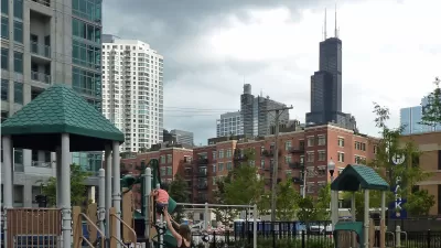
The Man Who Made Chicago Easy to Navigate
Edward Brennan waged an extended turn-of-the-century campaign to clean up Chicago's then-confusing address numbering system. Though few recognize his name, Brennan's legacy lives on in modern Chicago.
How to Design a City for Blackouts
During the nightly blackouts designed to protect London from aerial attack during World War II, authorities used white paint as a cheap tool for making the city navigable in the darkness. Could London offer lessons for building resilient cities?
Are You a Narrative or Spatial Navigator?
Jarett Walker finds out how many people can recognize north in the subway. The survey is used to explain the distinction between narrative and spatial navigation, which appear to be the two predominant forms of human navigation.
City of Costa Mesa
Licking County
Barrett Planning Group LLC
HUD's Office of Policy Development and Research
Mpact Transit + Community
HUD's Office of Policy Development and Research
Tufts University, Department of Urban and Environmental Policy & Planning
City of Universal City TX
ULI Northwest Arkansas
Urban Design for Planners 1: Software Tools
This six-course series explores essential urban design concepts using open source software and equips planners with the tools they need to participate fully in the urban design process.
Planning for Universal Design
Learn the tools for implementing Universal Design in planning regulations.


