


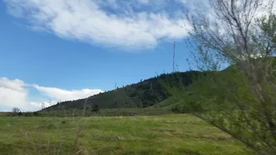
An interactive map from Chicago Cityscape shows all of the city's parking lots, vacant spaces, and city-owned land. Not all of it is truly vacant, or developable, but the map shows how much scope remains for new construction.

The folks over at Chicago Cityscape have upgraded their Property Finder map. According to founder Steven Vance, "The map's intention has always been straightforward: use open data to show all the land that is sitting there, across the city, but definitely concentrated in a few areas, waiting to be developed."
Categories of land include vacant spaces and portions of land owned by the city. The map also shows "over 4,600 parking lots, both surface and garage. Since the parking lots dataset comes from OpenStreetMap, where many individuals have drawn them in by hand, there are hundreds that have yet to be added."
Of course, not all the city-owned land is truly vacant, and neither is all the land labeled vacant. "The vacant land dataset, which comes from the Cook County Tax Assessor, is imperfect, too. It marks the space between buildings as vacant when they’re really not (used for driveways, garages, yards)."
Still, the map gives us an idea of where major infill development could occur. The majority of city-owned and vacant property is located in lower-income neighborhoods, both on the South Side (mostly west of the Dan Ryan Expressway), and west of downtown around Garfield Park and Lawndale. Parking lots are thickly spread south and west of the Loop, and along the river to the north.
FULL STORY: Look at all that developable land in the city

Chicago Planning Department Rejects 'Overparked' Six Corners Proposal
In a decision that is still impossible in most of the country, Chicago's Department of Planning and Development is requiring housing and reduced surface parking to approve a retail project.
Keeping Colorado Land from Development Could Cost $5 Million
In Golden, Colorado, residents want to keep a parcel of land as open space, but it could come with a hefty price tag.
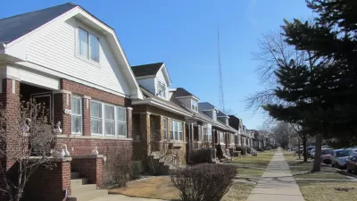
Mapped: Chicago's Shrinking Middle Class
In 1970, half of the city's census tracts were middle-income. Now, only 16 percent of them remain so. Polarization between the well-off and the poor essentially splits the city in two.

Pennsylvania Mall Conversion Bill Passes House
If passed, the bill would promote the adaptive reuse of defunct commercial buildings.

Coming Soon to Ohio: The Largest Agrivoltaic Farm in the US
The ambitious 6,000-acre project will combine an 800-watt solar farm with crop and livestock production.

World's Largest Wildlife Overpass In the Works in Los Angeles County
Caltrans will soon close half of the 101 Freeway in order to continue construction of the Wallis Annenberg Wildlife Crossing near Agoura Hills in Los Angeles County.

California Grid Runs on 100% Renewable Energy for Over 9 Hours
The state’s energy grid was entirely powered by clean energy for some portion of the day on 37 out of the last 45 days.

New Forecasting Tool Aims to Reduce Heat-Related Deaths
Two federal agencies launched a new, easy-to-use, color-coded heat warning system that combines meteorological and medical risk factors.

AI Traffic Management Comes to Dallas-Fort Worth
Several Texas cities are using an AI-powered platform called NoTraffic to help manage traffic signals to increase safety and improve traffic flow.
City of Costa Mesa
Licking County
Barrett Planning Group LLC
HUD's Office of Policy Development and Research
Mpact Transit + Community
HUD's Office of Policy Development and Research
Tufts University, Department of Urban and Environmental Policy & Planning
City of Universal City TX
ULI Northwest Arkansas
Urban Design for Planners 1: Software Tools
This six-course series explores essential urban design concepts using open source software and equips planners with the tools they need to participate fully in the urban design process.
Planning for Universal Design
Learn the tools for implementing Universal Design in planning regulations.