


A new visualization from the Smithsonian's National Museum of Natural History shows how the earth "breathes"—in the form of volcanic eruptions, earthquakes, and emissions.
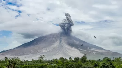
"Pretend that you're an alien in a spacecraft above Earth. You are looking down and watching the pulse of planet Earth. The breath, the respiration," says Elizabeth Cottrell, as quoted in an article by Sarah Kaplan.
Cottrell is a research geologist who directs the Global Volcanism Program at the National Museum of Natural History. She's describing the action of a new visualization of the planet's eruptions, earthquakes, and gas emissions. As she rotates the globe with a click of her mouse, blue dots signifying tremors and red triangles for volcanoes flare up and fade away, carving the planet's surface in predictable patterns. The animation emits a 'ping"'with each earthshaking event," writes Kaplan to explain the visualization.
The article provides additional discussion of why the visualization could be considered "cool" or "fascinating" rather than terrifying (especially for those of us living in California).
FULL STORY: Watch Earth pulse with earthquakes and eruptions in this stunning visualization
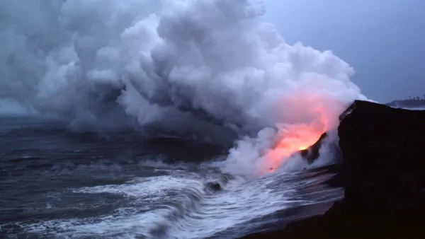
Friday Eye Candy: Mount Kilauea’s Volcanic Activity, Past and Present
Newly released images from NASA's terra satellite chronicles the history of lava on Hawaii's Big Island.

Judge Declares Federal Emissions Rule ‘Arbitrary and Capricious’
Another judge already vacated the rule nationwide before the latest case was decided.

New York Congestion Pricing Approved by MTA Board
The program took another step forward as the board approved a proposed pricing scheme, but lawsuits still stand in the way of full implementation.

Pennsylvania Mall Conversion Bill Passes House
If passed, the bill would promote the adaptive reuse of defunct commercial buildings.

World's Largest Wildlife Overpass In the Works in Los Angeles County
Caltrans will soon close half of the 101 Freeway in order to continue construction of the Wallis Annenberg Wildlife Crossing near Agoura Hills in Los Angeles County.

U.S. Supreme Court: California's Impact Fees May Violate Takings Clause
A California property owner took El Dorado County to state court after paying a traffic impact fee he felt was exorbitant. He lost in trial court, appellate court, and the California Supreme Court denied review. Then the U.S. Supreme Court acted.

California Grid Runs on 100% Renewable Energy for Over 9 Hours
The state’s energy grid was entirely powered by clean energy for some portion of the day on 37 out of the last 45 days.

New Forecasting Tool Aims to Reduce Heat-Related Deaths
Two federal agencies launched a new, easy-to-use, color-coded heat warning system that combines meteorological and medical risk factors.

AI Traffic Management Comes to Dallas-Fort Worth
Several Texas cities are using an AI-powered platform called NoTraffic to help manage traffic signals to increase safety and improve traffic flow.
City of Costa Mesa
Licking County
Barrett Planning Group LLC
HUD's Office of Policy Development and Research
Mpact Transit + Community
HUD's Office of Policy Development and Research
Tufts University, Department of Urban and Environmental Policy & Planning
City of Universal City TX
ULI Northwest Arkansas
Urban Design for Planners 1: Software Tools
This six-course series explores essential urban design concepts using open source software and equips planners with the tools they need to participate fully in the urban design process.
Planning for Universal Design
Learn the tools for implementing Universal Design in planning regulations.