


Georgetown's grid of small blocks is starkly different from the L'Enfant-designed city that surrounds it.
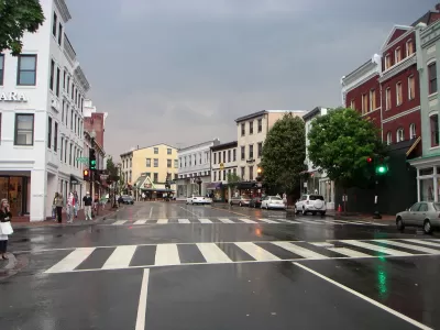
The origins of Washington, D.C.'s Georgetown neighborhood can be traced back to a Scottish man named Ninian Beall, who had the original grant for the land where the neighborhood would develop from a tobacco inspection station to a busy commercial port. Writing in Greater Greater Washington, Topher Mathews traces the history of the neighborhood to its eventual development into a grid comprised of small blocks.
The layout of Georgetown was a typical modest colonial town. The 80 lots were separated by only two streets and two narrow lanes. In the 1780s, several additions were annexed to the town.
...
While the physical structures hadn't filled in the street grid by the 1790s, Pierre L'Enfant nonetheless concluded that Georgetown was too developed with its own town plan to be incorporated into his Baroque plan for the city of Washington.
This design independence has survived to the present day as Georgetown lacks the circles and radials of the rest of downtown Washington.
Matthews notes that while Georgetown's original grid layout survived, many of its street names did not. As Washington, D.C. grew around it and eventually merged with it in 1872, many of the original street names were changed to match the D.C. street system.
FULL STORY: The story behind Georgetown's street grid
Is Washington D.C. Preserving Buildings or Hoarding Them?
A piecemeal, reactive approach to historic preservation in the capital may burden the future with too many buildings of "middling merit."
Georgetown-Rosslyn Gondola Proposal Gets a Funded Study
The idea of a gondola crossing the Potomac might still seem a little pie in the sky, but it has legs.
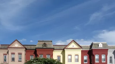
A New Future Proposed for Georgetown
After announcing its Georgetown 2028 Plan last year, the Georgetown Business Improvement District is continuing its ambitious efforts to bring new facilities and amenities online in Georgetown.

Pennsylvania Mall Conversion Bill Passes House
If passed, the bill would promote the adaptive reuse of defunct commercial buildings.

Coming Soon to Ohio: The Largest Agrivoltaic Farm in the US
The ambitious 6,000-acre project will combine an 800-watt solar farm with crop and livestock production.

World's Largest Wildlife Overpass In the Works in Los Angeles County
Caltrans will soon close half of the 101 Freeway in order to continue construction of the Wallis Annenberg Wildlife Crossing near Agoura Hills in Los Angeles County.

California Grid Runs on 100% Renewable Energy for Over 9 Hours
The state’s energy grid was entirely powered by clean energy for some portion of the day on 37 out of the last 45 days.

New Forecasting Tool Aims to Reduce Heat-Related Deaths
Two federal agencies launched a new, easy-to-use, color-coded heat warning system that combines meteorological and medical risk factors.

AI Traffic Management Comes to Dallas-Fort Worth
Several Texas cities are using an AI-powered platform called NoTraffic to help manage traffic signals to increase safety and improve traffic flow.
City of Costa Mesa
Licking County
Barrett Planning Group LLC
HUD's Office of Policy Development and Research
Mpact Transit + Community
HUD's Office of Policy Development and Research
Tufts University, Department of Urban and Environmental Policy & Planning
City of Universal City TX
ULI Northwest Arkansas
Urban Design for Planners 1: Software Tools
This six-course series explores essential urban design concepts using open source software and equips planners with the tools they need to participate fully in the urban design process.
Planning for Universal Design
Learn the tools for implementing Universal Design in planning regulations.