


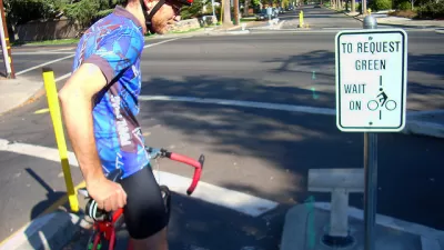
A new map quantifies the stress levels for bike riders on the streets of Montgomery County, Maryland.

Just north of D.C., transportation planners in Montgomery County, Maryland have created a Bicycle Stress Map, reports Laura Bliss:
With a new Bicycle Stress Map, county planners have quantified and mapped the “traffic stress level” of the county’s bike network, assigning a numeric value and corresponding color to every street and bike trail.
Peter Furth, from Northeastern University, created the methodology for the stress map, calculating "TSL" values "based on traffic speed and volume, the number and width of car and bike lanes, parking turnover, how easy it is to get through intersections, and other characteristics," explains Bliss.
In addition to providing more detail about the methodology of the stress map, Bliss also analyzes the portrait of the Montgomery County bike network that emerges as a result. Among the most clear takeaways from the map: that the bicycle network is often most stressful around Metro stations and Capital Bikeshare stations.
FULL STORY: Mapping How Stressful Streets Can Limit Cycling
‘Idaho Stop’ Now Legal in Colorado
Colorado is the latest state to make it legal for people on bikes to treat stop signs like yield signs when no cars are in the intersection.

Colorado Legislature Approves 'Idaho Stop' Bill
Pending Gov. Polis's signature on a bill approved recently by the Colorado State Legislature, Colorado will become the latest state to allow people on bikes to yield at stop signs.

Pedestrian Planning in Response to Worsening Safety Data
Faced with rapidly deteriorating pedestrian safety statistics, Montgomery County in Maryland is getting to work on a new Pedestrian Plan, following closely on the heels of work completed for the county's Bicycle Master Plan.

Pennsylvania Mall Conversion Bill Passes House
If passed, the bill would promote the adaptive reuse of defunct commercial buildings.

Coming Soon to Ohio: The Largest Agrivoltaic Farm in the US
The ambitious 6,000-acre project will combine an 800-watt solar farm with crop and livestock production.

World's Largest Wildlife Overpass In the Works in Los Angeles County
Caltrans will soon close half of the 101 Freeway in order to continue construction of the Wallis Annenberg Wildlife Crossing near Agoura Hills in Los Angeles County.

California Grid Runs on 100% Renewable Energy for Over 9 Hours
The state’s energy grid was entirely powered by clean energy for some portion of the day on 37 out of the last 45 days.

New Forecasting Tool Aims to Reduce Heat-Related Deaths
Two federal agencies launched a new, easy-to-use, color-coded heat warning system that combines meteorological and medical risk factors.

AI Traffic Management Comes to Dallas-Fort Worth
Several Texas cities are using an AI-powered platform called NoTraffic to help manage traffic signals to increase safety and improve traffic flow.
City of Costa Mesa
Licking County
Barrett Planning Group LLC
HUD's Office of Policy Development and Research
Mpact Transit + Community
HUD's Office of Policy Development and Research
Tufts University, Department of Urban and Environmental Policy & Planning
City of Universal City TX
ULI Northwest Arkansas
Urban Design for Planners 1: Software Tools
This six-course series explores essential urban design concepts using open source software and equips planners with the tools they need to participate fully in the urban design process.
Planning for Universal Design
Learn the tools for implementing Universal Design in planning regulations.