


The idea that proximity to transit equals higher land values doesn't tell the full story. According to this study, a variety of other factors must be in place to achieve the desired effect.
Boosters of transit-oriented development often operate by the assumption that land values will rise, inevitably, next to transit. Laura Bliss writes, "Cities can 'capture' this 'land value uplift' to pay for transportation infrastructure projects (for example, by creating a special tax on certain developments that are projected to benefit most from the expanded transit access)."
The results of a recent study throw some doubt on that simple equation. While transit does stimulate land values in some locations, in others it has little effect. "[...] the results of some [heavy rail transit] studies are insignificant, negligible, or even negative, and there are sometimes stark differences between studies in the same city."
Two factors complicate the picture. First, badly-sited new transit may not provide real benefits on the ground. "If a neighborhood is already well served by convenient access to a highway system, or by cycling and pedestrian options, a wonderful new transit line might not result in more 'accessibility.'"
Second, looking at proximity by itself ignores how well—or how poorly—other factors are complementing the transit. "For example, mixed-use zoning, open and public spaces, amenity-rich neighborhoods, and pedestrian-oriented street design all carry positive effects on land value. When models overlook these factors, they paint an incomplete picture of projected land values in an area—and even worse, the authors write, researchers can mistakenly claim them as empirical evidence of the benefits of accessibility."
FULL STORY: Does Transit Always Increase Land Value?
Making TOD More Viable
Tying housing and land acquisition funding to transit projects could make dense, walkable development easier and more cost-effective.
How Federal Policy Can Encourage TOD
Tying transit and land acquisition funding together could help produce more housing near transit hubs.
Mixed-Use TOD Planned in Jacksonville
The project will include affordable housing and retail space near the Rosa Parks transit station.

Pennsylvania Mall Conversion Bill Passes House
If passed, the bill would promote the adaptive reuse of defunct commercial buildings.

Planning for Accessibility: Proximity is More Important than Mobility
Accessibility-based planning minimizes the distance that people must travel to reach desired services and activities. Measured this way, increased density can provide more total benefits than increased speeds.

World's Largest Wildlife Overpass In the Works in Los Angeles County
Caltrans will soon close half of the 101 Freeway in order to continue construction of the Wallis Annenberg Wildlife Crossing near Agoura Hills in Los Angeles County.

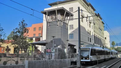
How Transit Architecture Impacts Real and Perceived Safety
More than a third of Americans believe major transit systems are too unsafe to ride. The built environment can change that.

New York Passes Housing Package Focused on New Development and Adaptive Reuse
The FY 2025 budget includes a new tax incentive, funding for affordable housing on state land, and support for adaptive reuse and ADUs.

LA Metro Board Approves New 710 Freeway Plan
The newest plan for the 710 corridor claims it will not displace any residents.
City of Costa Mesa
Licking County
Barrett Planning Group LLC
HUD's Office of Policy Development and Research
Mpact Transit + Community
HUD's Office of Policy Development and Research
Tufts University, Department of Urban and Environmental Policy & Planning
City of Universal City TX
ULI Northwest Arkansas
Urban Design for Planners 1: Software Tools
This six-course series explores essential urban design concepts using open source software and equips planners with the tools they need to participate fully in the urban design process.
Planning for Universal Design
Learn the tools for implementing Universal Design in planning regulations.